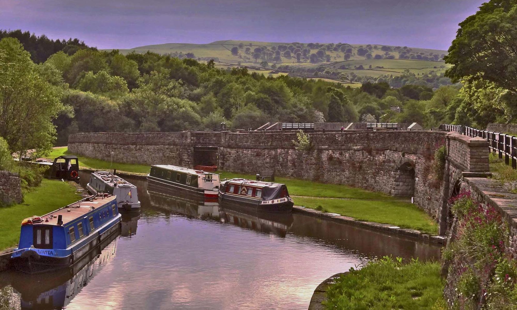
The Terminal Basin is situated adjacent to the village of Buxworth, Derbyshire, at Grid Ref SK 0221.8202, 1.2 km north-east of Whaley Bridge. The canal lies 158 m above sea level, and lies entirely within the Chinley, Buxworth and Brownside Parish boundary.
The complex lies in a natural valley, cut by the Blackbrook, which flows from the south-west slope of Brown Knoll below Edale Moor to the north of Bugsworth Basin to join the River Goyt 150 metres west of the Britannia Mill. The course of the Blackbrook once ran through what is now the basin complex, and was rerouted c1795 to allow the construction of the canal terminus.
Boat
Bugsworth Basin is a popular destination for boaters. Note that moorings cannot be prebooked, and are are occupied on a first come, first served basis. At peak times the basins are often the venue for club and organisation cruises with up to 60 boats arriving unannounced.
Walk
There are many footpaths that can be taken to Bugsworth Basin including a short detour from the Goyt Way, just before bridge 34, along the canal into the Basin. The Goyt Way is a 10 mile easy access walk from Whaley Bridge to Etherow Country Park. The route initially follows the towpath of the Peak Forest Canal and later the path of the River Goyt.
The Peak Forest Tramway Trail has been re-opened from Bugsworth Basin for 2.6kms to Charley Lane near Bridgeholm Green. From there you can take public footpaths to see the historic viaducts in Chapel Milton and on to Chapel-en-le-Frith where bus and rail services will return you to Buxton or Whaley Bridge. The Peak Forest Tramway brought limestone and gritstone from local quarries to be loaded onto boats at Bugsworth Basin.
Bugsworth Basin can be found on the Ordnance Survey Explorer map OL1.
Cycle
Bugsworth Basin is on the Pennine Cycleway, part of National Cycle Network Route 68.
Car
There are free car parks at Whaley Bridge and Chapel-en-le-Frith. The Navigation Inn at Bugsworth Basin has a car park for their customers.
Train
Bugsworth Basin is a short walk from either Whaley Bridge, on the Buxton to Manchester line, along the canal, or from Chinley on the Manchester to Sheffield line, via the Peak Forest Tramway Trail.
Bus
Local bus services 189 and 190 run from Buxton via Chapel-en-le-Frith, Chinley and Buxworth to Whaley Bridge. No Sunday Service but the 199 does run from Buxton, via Whaley Bridge and Stockport, to Manchester Airport.