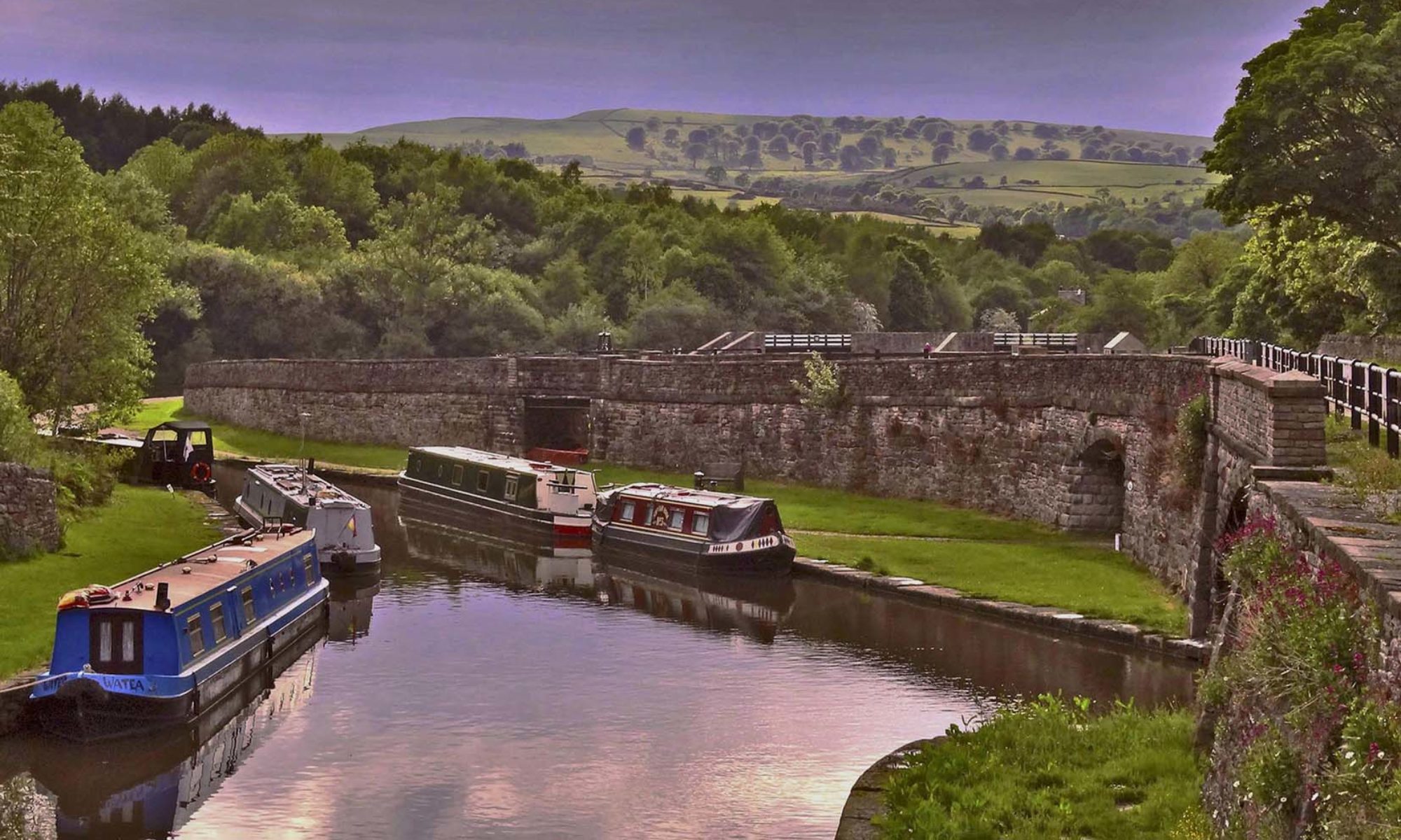
Opening in 1798 the Dudley No 2 Canal was built to avoid going through Birmingham and having to pay tolls. It ran from the Dudley No 1 Canal at Parkhead to the Worcester & Birmingham Canal at Selly Oak. 11 miles in length it cut through the hills rather than locking over, giving two tunnels, the 563 yard long Gosty Hill tunnel and the 2.2 mile long Lapal tunnel. The Lapal tunnel was initially worked by legging, which could take up to four hours. Later a pumping engine was installed at the Halesowen end of the tunnel, pumping water over a stop plank to flush boats through. This allowed the tunnel to operate in three hourly slots from alternate ends, the first being at 4 a.m. and the last at 10 p.m. indicating that the canal must have been pretty busy. However, there were regular problems with the straight sided tunnel and it was frequently closed for repairs. When the tunnel was finally closed in 1917 the original width of 9’ had reduced to 7’ 9 “ and the height reduced to 6’. Andy Tidy’s YouTube video explains it well:
The west end of the canal is still navigabale from Parkhead to Windmill End, through Gosty Hill tunnel to Hawne Basin. The Lapal Canal Trust was founded in 1990 to conserve and restore the five and a half miles from Hawne Basin to Selly Oak. Restoration has started on the ‘lost’ section of the canal but the Lapal tunnel is beyond repair. To rejoin the two ends of the canal would mean taking an alternative route and entail building several locks (more on this later)
Hugh Humphreys, Simon Dearn and Dave Pearson from the Trust kindly agreed to be guides for our walk and provided a wealth of information about the canal, the current restoration and future aims of the Trust. We met at Selly Oak where restoration work has started on the two mile section to California, the eastern end of Lapal tunnel.
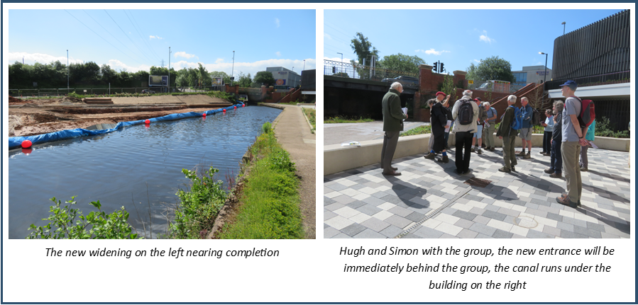
A student accommodation building and subsequently Selly Oak shopping centre have been built over the original junction with the Worcester & Birmingham canal but the canal has been diverted to the edge of the development where a concrete channel has already been built as part of the redevelopment programme.
Almost completed, when we visited, is a widening on the opposite side of the Worcester & Birmingham canal to allow boats to turn into the entrance of the Dudley No 2. The junction itself presents difficulties as there is currently a gas main and fibre optic cable running through it. These will need to be lowered below canal bed level. The quote for the gas main alone is a staggering £800k. There is funding of £724k available from the development agreement but this has to be commenced by 2025, so there is pressure to get this first part restored quickly in order to release the money. A swing bridge also needs installing at the junction.
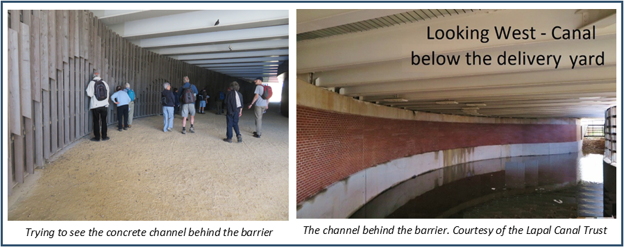
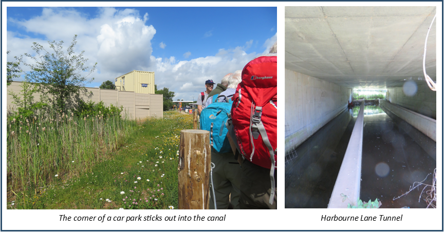
Beyond the concrete channel the line of the canal is obvious and just needs excavating but there are two very narrow sections where the corners of a retailer’s car park and land owned by Homebase jut out into the channel. Both have agreed to these corners being removed.
The canal soon meets Harbourne Lane, a very busy road. A bridge with concrete channel under has been built but is not yet accessible as the towpaths have not been filled in. It also has to have lighting installed as it is classed as a tunnel.
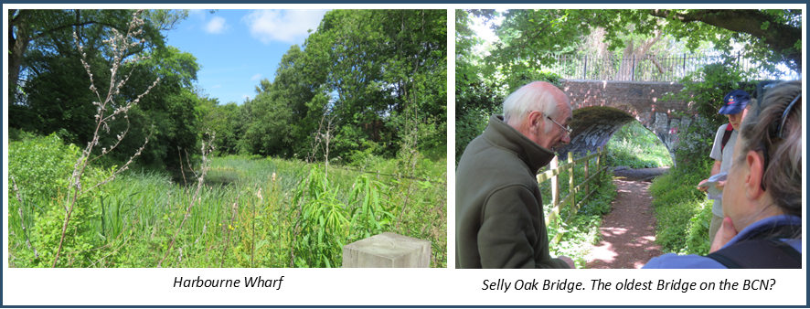
On the other side of the road is Harbourne Wharf Basin, which is in water having been excavated in 2015, this will be the end of the first stage of the restoration.
Just beyond here Selly Oak bridge is the only remaining brick arch bridge on the canal and contender for the oldest bridge on the BCN. The towpath used to continue on this side of the canal but this bridge will become a turnover bridge with the towpath running along the edge of Selly Oak park. In 2016 and 2017 WRG volunteers repaired the canal side wall leading up to the bridge and this summer will be returning to construct a wheelchair accessible path from the bridge down to the towpath.
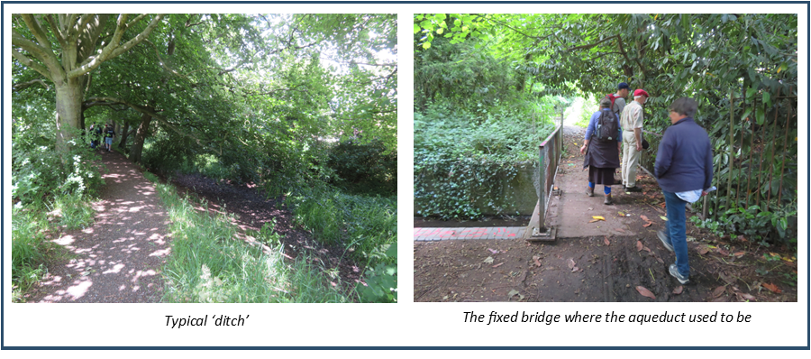
The next section of the canal is the fairly typical muddy ditch complete with trees and undergrowth. Three new bridges will have to be installed along here: a replica drawbridge, a new fixed bridge and a swing bridge. A little further along the canal crosses Bourne Brook on a fixed bridge, there was originally a small aqueduct here, another obstacle for the Trust.
Soon after this the canal passes alongside Weoley Castle , the remains of a moated manor house owned by Birmingham Museums
https://www.birminghammuseums.org.uk/weoley/about
which would provide a good place of interest for boaters on the restored canal.
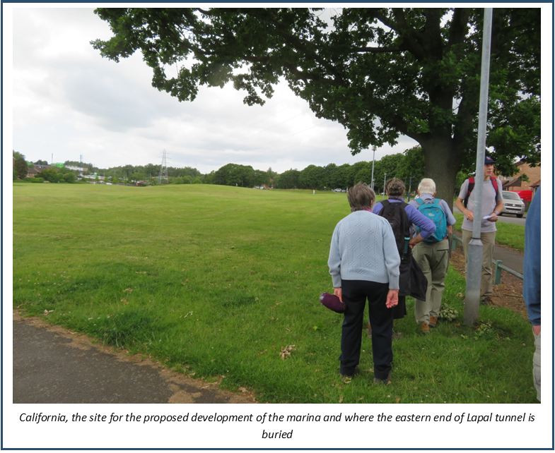
We were now approaching California where a triple staircase lock is planned leading into a large marina and would initially be limit of navigation. The Eastern end of the Lapal tunnel was here, but there is now no sign of it. The site has also been used for landfill at one time. The plan is to redevelop the whole site for housing and the marina possibly with a boatyard business and hire base.
Our morning walk finished here. We shuffled cars to the Lighthouse pub, handily placed above the southern end of Gosty Hill tunnel, the very obliging landlady putting on a spread for us and allowing us to leave cars there for the afternoon.
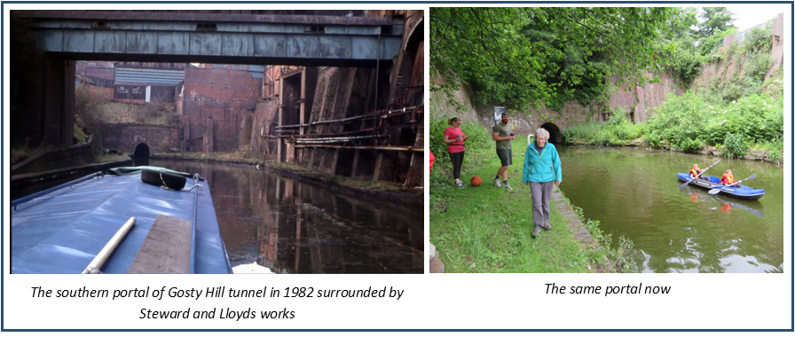
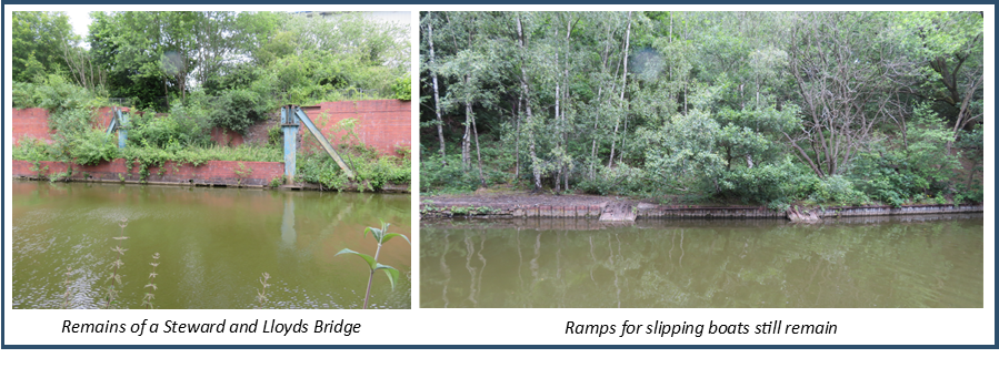
We returned to the canal at the Gosty Hill tunnel portal where there are fascinating remains of Steward and Lloyds, the largest steel tube factory in England. Immediately after this the remains of ramps are visible, these were used the slip boats from a boatyard next to Steward and Lloyds.
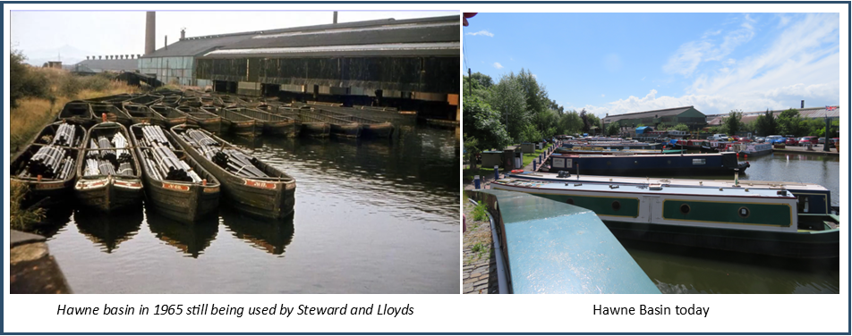
We were now approaching Hawne Basin and the towpath stops as you reach Coombeswood Trust land. We detoured by road to the Trust’s gates to be given a guided tour of the basin. This was originally a transhipment basin for coal from Hawne Colliery, later for steel tubes from Steward and Lloyds. It now has leisure and residential moorings and boatyard facilities.
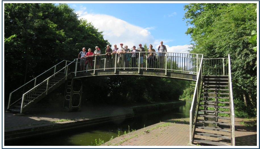
Just past the end of the basin the canal comes to a full stop. Beyond here the line of the canal is very overgrown. We retraced our steps to Coombs Bridge, crossed the canal and continued walking along a path on the other side. We soon reached the busy A458 which the canal has to cross but, being elevated, there is room to take the canal underneath.
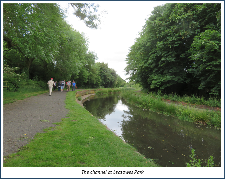
Once across the road the canal runs on a high embankment alongside the delightful Leasowes Park which has Grade 1 listing of parks and gardens of historic interest. Here the channel has been rebuilt but unfortunately was done cheaply and doesn’t hold water properly.
The next obstacle is Manor Way, another substantial and busy road. The canal will have to be diverted here to cross lower down the hill where an aqueduct could be built. Across Manor Way is the western end of Lapal tunnel. For the canal to become a through route again it would have to divert to the north of the tunnel through Woodgate Valley Country Park. This would mean building several locks to traverse the hill and involve a major junction crossing.
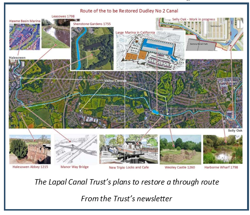
Fully restored the Dudley No 2 canal would provide a great through route from the Stourbridge canal to the Worcester and Birmingham and another loop on the system.
Further information is available on the Trust’s website and facebook site:
www.facebook.com/lapalcanaltrust
Many thanks to Hugh, Simon and Dave for a guided walk full of interest and to Hugh for providing transport to return drivers to their cars. Much thanks also to Paul Niblett for his excellent organisation.
Next time out: Saturday 6th August. In search of the Runcorn and Latchford Canal
