Building of the Rochdale canal started in 1794 at Sowerby Bridge. It took a workforce of 500 navvies 10 years to build this 32 mile long canal which rises 350 feet through 36 locks to summit level then drops 435 feet through 56 locks into Manchester, making it the most heavily locked canal in the country.
This was the first transpennine canal to open and the only one with no tunnels as William Jessop did not trust the technology at that time. It was however considered to be the most difficult canal on which to work.
Being a wide canal the Rochdale was more successful than the Huddersfield Canal and became the main means of transport between Lancashire and Yorkshire with cotton, wool, coal, timber, salt, cement and grain dominating.
Although inevitably hit by railway competition, by cutting tolls the canal did manage to retain trade and remain profitable until the first world war but by 1920 the Rochdale was in financial trouble. Then in 1923, the Oldham and Rochdale Corporations Water Act paved the way for the transfer of its eight reservoirs to those corporations to supply drinking water. The last cargo of raw cotton arrived at Littleborough in 1929 and the last complete journey of the Rochdale took place in 1937. During the Second World War, barges were plucked from the canal and placed on its reservoir at Blackstone Edge in a cunning plan to stop Hitler landing water planes, their carcasses being found when the reservoir was recently drained.
Closure was authorised in 1952, except for the 1½ miles at the Manchester end from Ashton Canal junction into Castlefield Basin, then in 1962 the canal was cut in two when the M62 was built.
An Act of Parliament was sought in 1965, to authorise the abandonment of the canal, which the Inland Waterways Association petitioned against. When it was finally passed, it contained a clause that ensured the owners would maintain it until the adjacent Ashton Canal was abandoned. The Ashton Canal, which joins the canal above lock 84, reopened in 1974, and the nine locks on the Rochdale Canal to Castlefield basin were restored at that time.
The Rochdale Canal Society was formed to promote the restoration of the canal and in the 1980s and 1990s small scale work began to re-open stretches of the canal between Todmorden and Sowerby Bridge. This involved restoring bridges and locks to navigable condition. The Calderdale section of the canal reopened in the 1990s and the real celebrations began when lottery funding became available. Because it had stopped carrying traffic by the 1940s, the canal had not been nationalised and not filled in when it became derelict. This allowed ownership to pass to the Waterways Trust in 2000 and British Waterways were given the monumental task of restoring it to full use.
Funding of 23 million pounds was announced, mostly from the Millennium Commission and English Partnerships that would enable the remaining obstacles to be removed. It entailed refurbishing 24 locks, building 12 new road bridges, 50,000 cubic metres of dredging and building 900 metres of new canal channel. In July 2002 the canal re-opened, almost 200 years after its original opening.
Our walk was from Castleton to Littleborough where the many blockages were removed during this final period of restoration prior to re-opening, between 2001 and 2002. The M62 crossing just south Castleton seemed a good place to start.
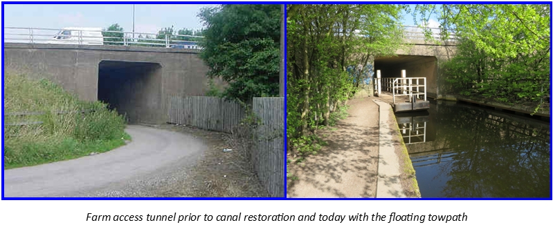
No provision had been made for the canal when the motorway was built, however there was a farm access tunnel just to the side of it. As the motorway climbs steeply at this point there was enough height to take the canal through here with the farm access diverted. A public inquiry and a High Court ruling was needed before land could be compulsory purchased from two farmers.
The original lock 53 was replaced with a new lock south of the motorway to raise the canal to the level of the tunnel, the concrete was still drying when the canal was reopened on 1st July 2002.
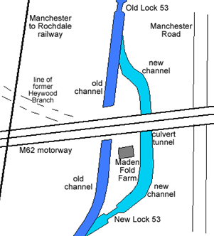
A towing path was needed here as there is no way for a walker to cross the M62 but as the tunnel is just wide enough for a wide beam boat a floating towing path was installed leaving enough space for a narrowboat but removable should a wide boat require access.
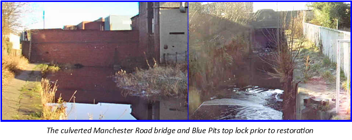
A few minutes walk took us into Castleton, a relatively modern town by British standards it is believed to date from the early 1700’s and until 1875 was known as Blue Pits, named after a local quarry which mined blue sand. Lock 51 here is named Blue Pit top lock. This lock had been in good condition and just needed cleaning, pointing and new gates fitting but Manchester Road bridge below the lock had been culverted and a brick retaining wall build blocking the canal.
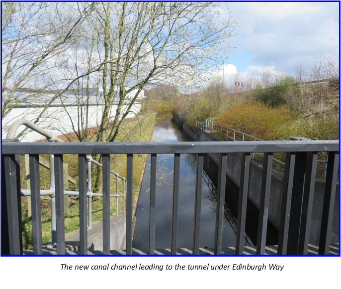
There had been many blockages through Rochdale, the next one on our walk was Edinburgh Way, a major road where a large roundabout had completely blocked the route. The original plan was for the whole roundabout to be raised to allow a new 90 metre long tunnel to pass below. The plan was revised so that the roundabout was replaced by a signal-controlled junction, with a new channel for the canal and a shorter tunnel under the road.
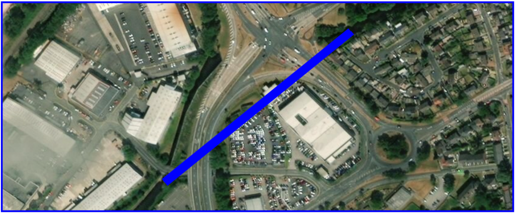
There is no towing path through this section, signposts take walkers on a diversion round the roads with just a glimpse of the new cutting.
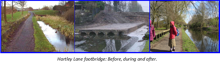
The next two bridges had been dropped and culverted needing excavating and reconstructing. Then the canal passes what used to be the Sealocrete works which was built on the site of Dickon Green Cotton Mill. The factory had encroached onto the canal channel narrowing it to only a few feet across, too narrow for even a narrowboat passage. As part of the restoration work a new concrete channel was constructed, wide enough for passage of a wide beamed boat.
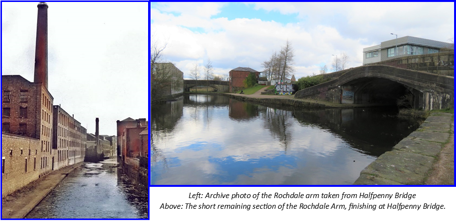
Next we reached the junction with Rochdale town arm, running for half a mile from Halfpenny Bridge – “a rare survival of a toll bridge over a canal” which is now grade II listed – to Richard Street basin.
Warehouses once lined its banks but its intrusion into the town meant it was a prime target for redevelopment and it became one of the first parts of the canal to be filled in during the late 1960s. A retail shopping centre now covers most of the canal arm, with the former basin serving as the car park.
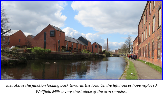
Back on the main line and through the turnover bridge are two locks, between these on the offside were Wellfield Cotton Mills and Wellfield Corn Mill, here another arm ran around and between the mills.
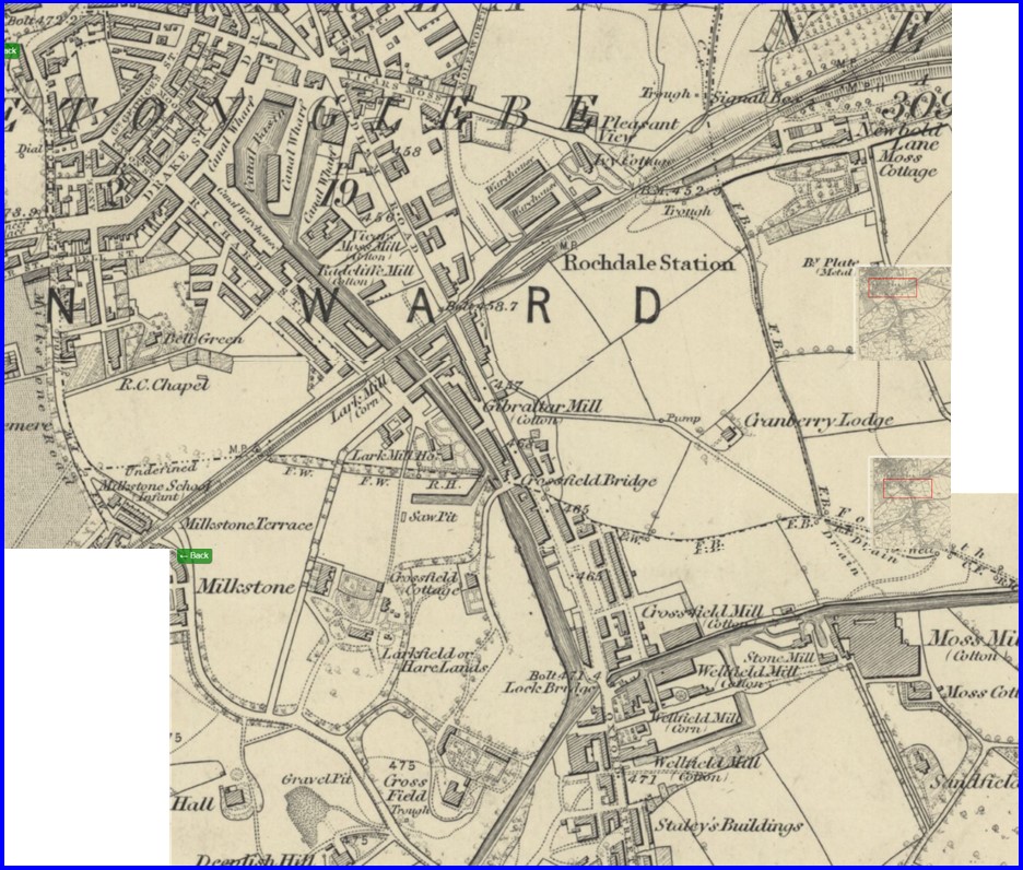
The mills are long gone and have been replaced by housing with a road running over the line of the canal arm although the start of the arm still remains.
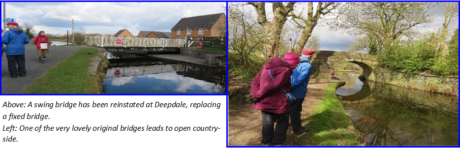
This was the half way point of the walk and soon after a short diversion took us to the Hornet for some very welcome food. The afternoon walk saw us leaving Rochdale and heading into countryside. There are a few more reinstated bridges between here and Littleborough, but also some elegant original stone bridges to admire complete with deep rope marks.
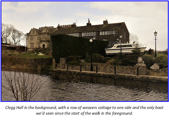
As snow started to fall we approached Clegg Hall which is supposedly haunted by a boggart. This 17th century hall replaced an earlier moated hall where legend has it that a wicked uncle killed his two nephews and then tried to kill his brother in order to gain the Hall and lands. The uncle got his comeuppance and is said to haunt the hall along with one of his nephews.
To one side of the Hall is an attractive row of weavers cottages and to the other side a small stone built mill which has been restored and converted to housing.
There had been two more bridges blocking the channel between here and Littleborough, Smithy Bridge and Ben Healy Bridge. Restoration of these bridges entailed closing and diverting roads and excavating huge amounts of rubble as well as diverting service pipes and cables. Ben Healy Bridge, at Littleborough is now the biggest bridge on the canal at 33 metres long. The road having been widened and angled across the canal, it has cut into an area that used to be a wharf which served Cleggs Wood Colliery where fire clay was extracted. Coking ovens were located at the side of the wharf, between the canal and the road but there is no longer any trace of these.
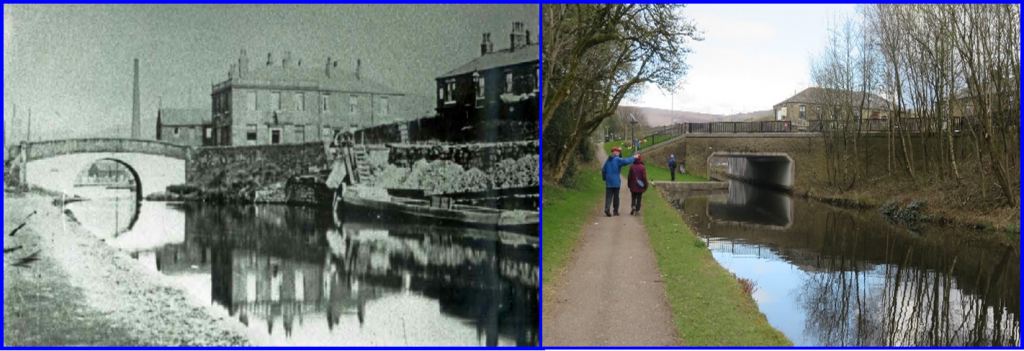
Just through the bridge we arrived at Littleborough Wharf and the end of our walk. It had been a typical British spring day of sun and snow showers.
Next time out: Saturday 11th June. The Lapal Canal