The walk was planned to coincide with a Heritage Open Day run by The Caldon and Uttoxeter Canals Trust who would be showing visitors around Crumpwood Wier and have information about the restoration of the canal. A few days earlier the good news had come that a planning application at Froghall for a housing estate to be built over the start of the canal had been turned down on many counts, one of which is that it didn’t make provision for the future restoration of the canal.
The Uttoxeter Canal was short lived, having been something of a white elephant for the Trent and Mersey Canal Company. In 1795 the Commercial Canal had been proposed – a wide canal linking Ashby-de-la-Zouch in Leicestershire with the River Trent and canals in Cheshire and Newcastle-under-Lyme. If built this would have been a severe competitor to the Trent and Mersey Canal. After a period of conflict the Trent and Mersey’s powerful connections and a promise to widen their canal they won the battle in 1797, with a victory for the Froghall to Uttoxeter canal scheme.
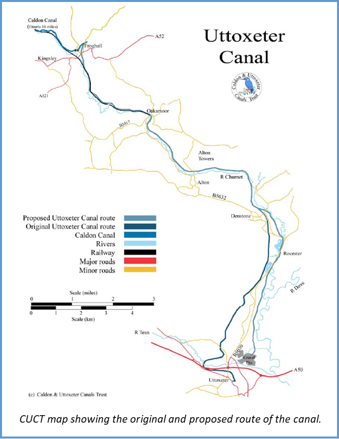
The canal widening never happened and the narrow canal was finally opened in 1811 running for 13.25 miles from Froghall to Uttoxeter with 17 locks along its length. Operating at a loss it closed in 1849 after being sold to the North Staffordshire railway who built their line over much of the canal. Over 170 years later it is amazing that there is anything left of the canal.
The Churnet Valley Railway line now runs from Leek Brook to Froghall with the line laid as far as Oakamoor sand sidings at the north end of Oakamoor village.
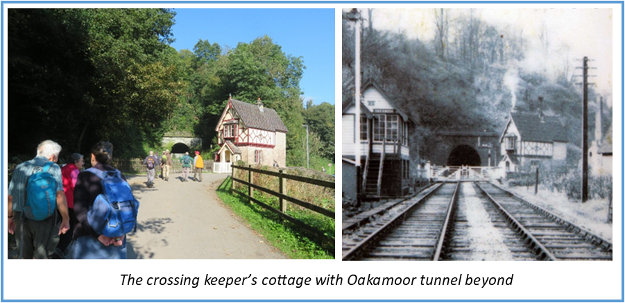
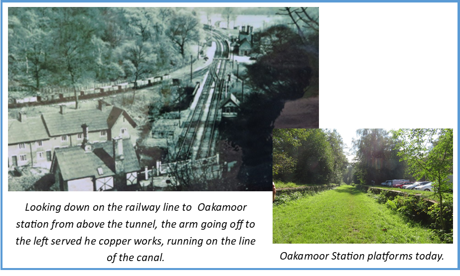
Our walk started in Oakamoor. Having parked in the station car park we started by looking at the remains of the railway. The railway didn’t follow the line of the canal through Oakamoor but went around it which necessitated building at tunnel. Several tunnels had to be built for the railway where the river course was hostile At 462 yards Oakamoor tunnel was the longest, it was also the wettest creating endless maintenance problems during its use. At the station side of the tunnel is a road crossing, the original crossing keeper’s cottage is now a holiday home and the current residents kindly showed us historic photos from the cottage.
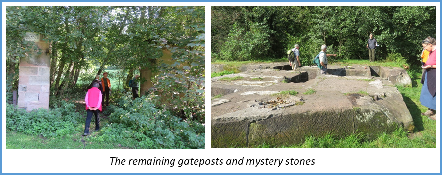
From here we cut across to Oakamoor Picnic Site, now a pleasantly green site with the River Churnet running through but which had been the site of Oakamoor copper works. Oakamoor had been a site of metal working for some 800 years. In 1790 copper smelting began, mostly for factories in Birmingham. The business was bought in 1852 by Thomas Bolton and Sons, production continuing on the site until closure in 1962, after which the works were demolished. The factory was served first by the canal and then by an arm from the railway.
All that remains of the factory now are two gate posts and some seriously large stones, presumably bases for machinery and/or cranes, we spent some time puzzling over these – although there are several historical information boards around Oakamoor there is no mention of these stones.
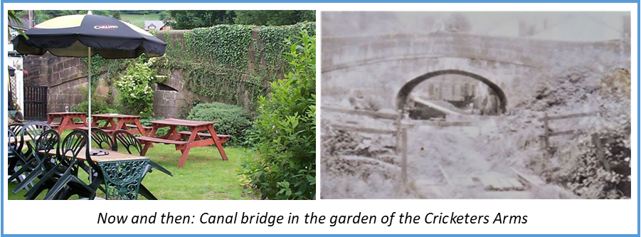
In the centre of Oakamoor is the Cricketers Arms where we saw the first trace of the canal. The canal ran through what is now the pub’s garden (the pub predates the canal) and under the main road. The bridge is filled in but still intact.
With the bridge as a starting point we could now follow the line of the canal through the recreation area to Oakamoor station where the platforms survive.
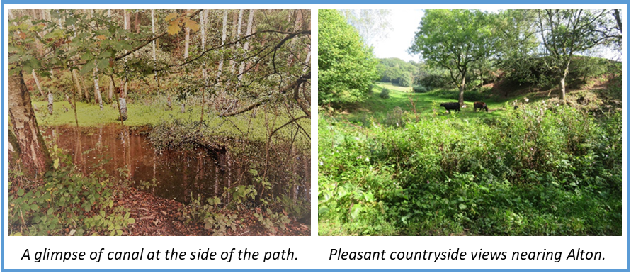
From here we followed the track bed of the railway for a couple of miles to Alton, the Churnet Valley railway also wish to reinstate the line from Oakamoor sands to Alton which could provide the opportunity of a restoration partnership. This stretch is undeveloped and a popular walking and cycling route, making restoration look relatively easy. However underground are large gas, electric and sewage mains, it would be prohibitively expensive to divert or re-lay the 11kV cable which follows the line of the canal so it would be necessary to construct the canal adjacent to the cable, moving it only where required. The canal would have to continue on the north east side of the railway so cuttings and a couple of locks would be needed.
This was a very pleasant stretch through peaceful and pretty countryside, the railway of course ran straight and loops of canal remain on each side.
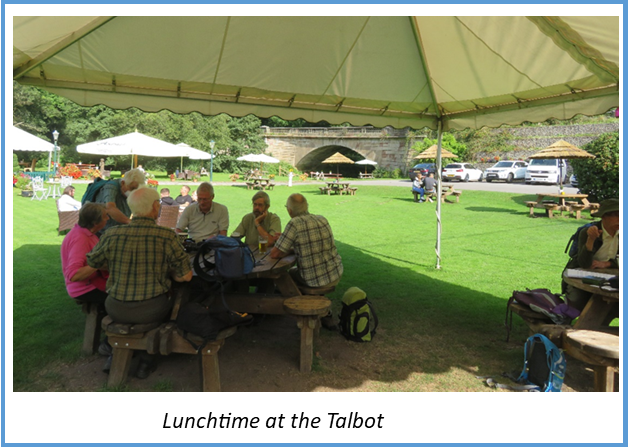
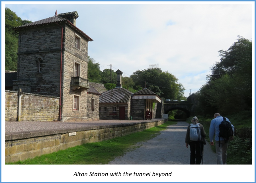
The morning walk finished at Alton station which has survived and is a Landmark Trust holiday home. We diverted at this point to visit the Talbot Inn for lunch. This proved a delightful place for a break, with large gardens at the side of the river, excellent food, beer, ice cream and service were appreciated by all.
Replete we returned to the station for the afternoon walk. Immediately after the station is Alton tunnel which took the track under the main road. This replaced a smaller canal tunnel which had a slightly different alignment to the railway tunnel but was about the same length.
From here to Denstone is the easiest section to restore as the canal is mostly still there. Significant clearing, dredging and probably re-lining would be needed which could be undertaken by volunteers and a new lock would be needed at the Alton end.
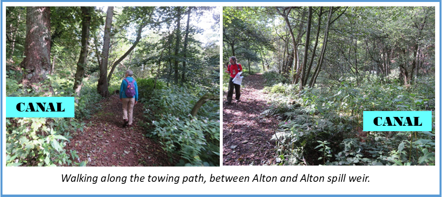
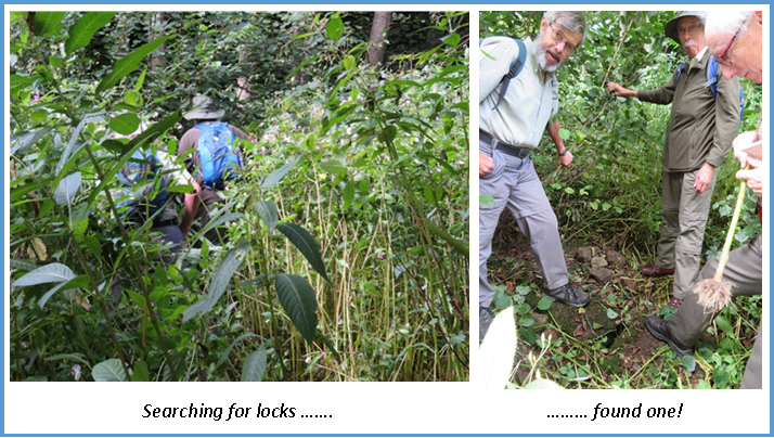
Soon after leaving Alton we were able to leave the railway bed to walk along the towing path which we followed most of the way to Crumpwood weir. The first section to Alton spill weir felt most like walking through forest but the towing path is clear. An intrepid group of walkers braved the undergrowth in search of locks.
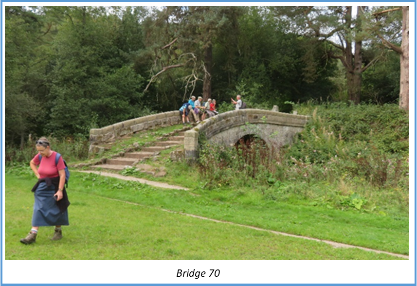
Bridge 70 is the only complete original bridge on the canal. Built around 1810 it was saved from collapse by volunteers who restored it between 2012 & 2106. The original wooden rubbing strake is still attached.
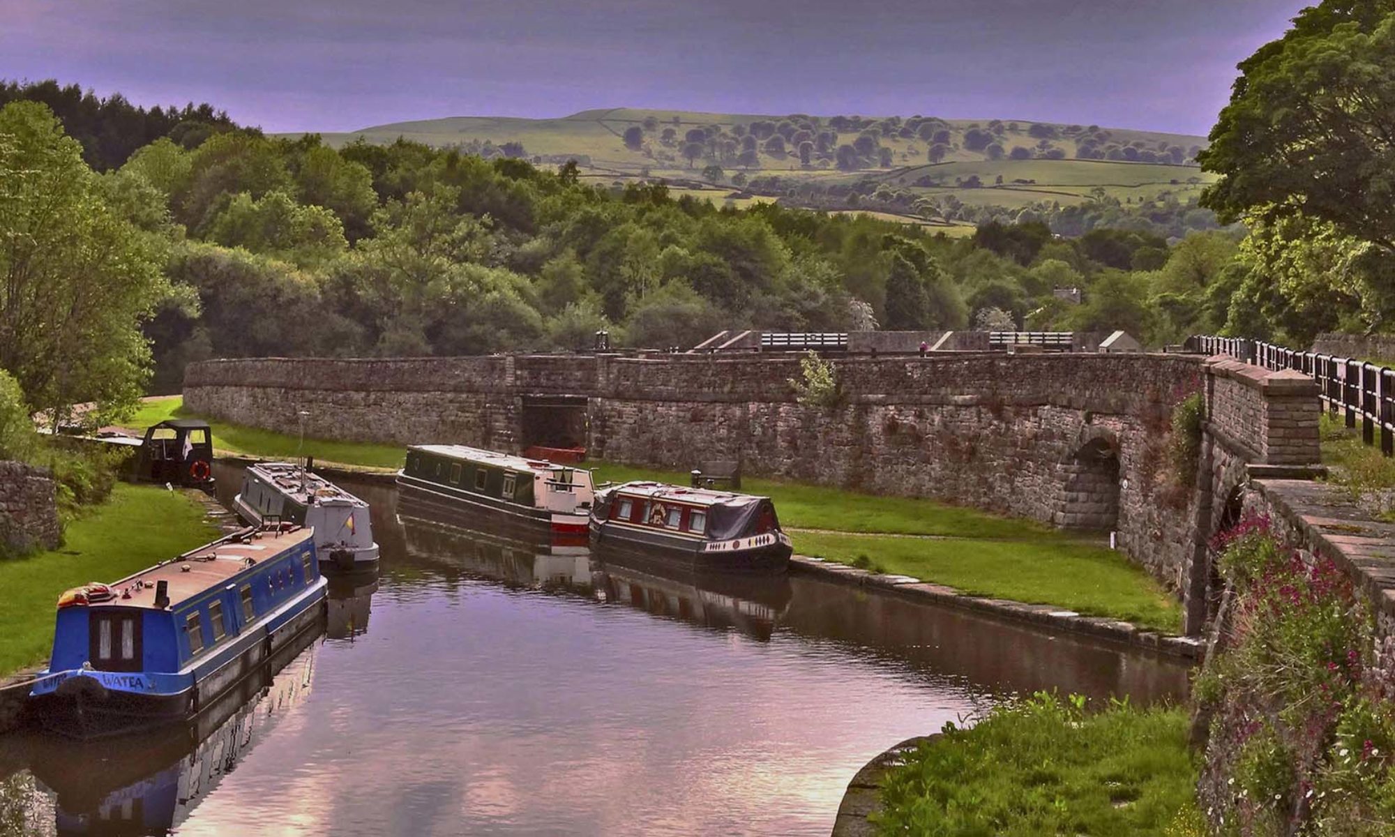
And so onward past Carrington’s lock, which dropped boats down to river level, to the star of the show – Crumpwood weir – where the CUCT had a stall with information boards and Alison Smedley gave us a guided tour around this unique feature.
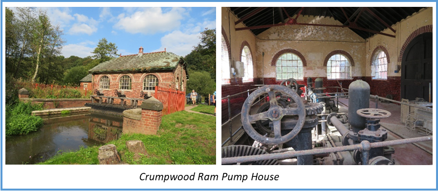
First we passed the Crumpwood Ram Pump House, a very unusual and possibly unique waterworks this was built between 1922 and 1928 to supply the Uttoxeter area with fresh water from nearby springs.
It’s unusual in that the pumps were powered by water turbines, using the head provided by an adjacent weir. There are 3 x 11 hp turbines made by Gilbert Gilkes & Co., each working a set of triple ram pumps, which had a combined output of about 15,000 gallons/hour under favourable conditions.
The pumphouse closed in the late 1970’s/1980 due to increased episodes of pollution in the supply but the pumps are still in place inside. It has recently been modified to allow fish to bypass the weir and get further up the river. Originally the environment agency wanted to get rid of the weir which would have seriously affected the canal restoration and destroyed a the unique structure so this alternative solution was found.
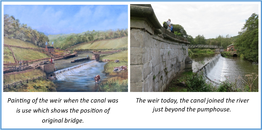
Crumpwood Weir is now protected with a grade II listing being the only structure of it’s type in the world. It was constructed within the River Churnet between 1807 and 1811 as part of the construction of the canal.
Alison led us across the river on a modern bridge not normally open to the public, the original bridge was further up river leading straight from the towpath of the canal.
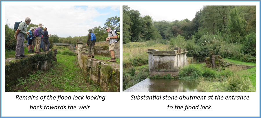
The weir is about 30 metres long with a vertical drop of 1.5 metres. At the Denstone end of the weir is the flood lock which has an impressive stone abutment on the weir side with architectural embellishment. Within the abutment at each end of the weir are two large sluices to allow the area behind the weir to be drained in times of low water level for the removal of silt.
The flood lock had double sets of gates that could be closed if the river level was too high or low although they were normally left open.
The canal continued into Denstone but as can be seen there is currently no path to follow so we returned to the railway bed for the final part of the walk into Denstone. Once again there were glimpses of canal bed alongside the path.
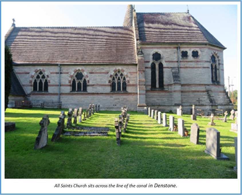
In Denstone the railway bed and station platforms still remain but the canal has been lost. The railway and canal took slightly different routes here, the railway having been built about 30 yards to the west of the canal. As this section of the canal was not needed by the railway it was sold and All Saints Church was built on the site.
Proposed restoration is for the canal to run to the east of Denstone, close to the river, necessitating the building of two new locks. This would be the start of a new route into Uttoxeter as the original line is built over there too.
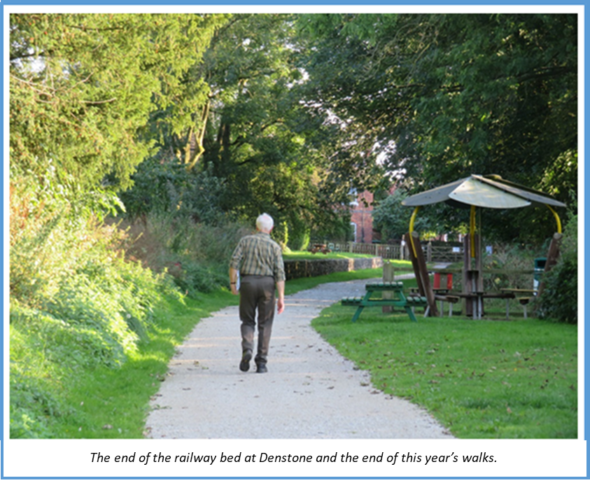
This was the end of our walk and the last walk for this year. We hope to have a full programme of walks for next year and be able to start again in April.