The second of our Huddersfield Canal walks, this time we tackled the west side starting at Portland Basin and finishing at Standedge tunnel. Portland Basin is the junction of the Ashton and Peak Forest Canals and site of the big dig of 1972 which some of our walkers were involved in. Now a very attractive site, Portland Basin Industrial Museum, in the rebuilt nineteenth century Ashton Canal Warehouse with working boats outside, dominates.
Although the Huddersfield Narrow is often thought of as starting at Portland basin, the Ashton continues for almost half a mile towards Stalybridge to the start of the Huddersfield. Only a few minutes up the canal is the Asda tunnel. Built on the site of a cotton mill Asda was built over the canal, the tunnel that goes under it has no towing path so it is necessary to divert up to Cavendish Street where the imposing Cavendish Mill has been converted into flats. After crossing this very busy main road and walking through Asda car park we regained the towing path where a railway viaduct passes overhead. In 1845, 15 navvies were killed here when several arches of the viaduct collapsed. A short way from here the Huddersfield Narrow starts at Whitelands Bridge where a horse tunnel leads to lock 1W.
Immediately after lock 1W is Whitelands tunnel. This was originally 150 yards long, but was opened out in the 1850’s leaving a cutting with three bridges, the top one appears to be part of the original tunnel.
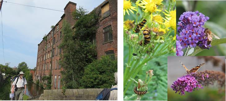
The stretch of canal from Ashton to Stalybridge was at one time lined with Mills, now many are gone or derelict. This very industrial area is being reclaimed by nature and we were pleased to see a variety of wildlife.
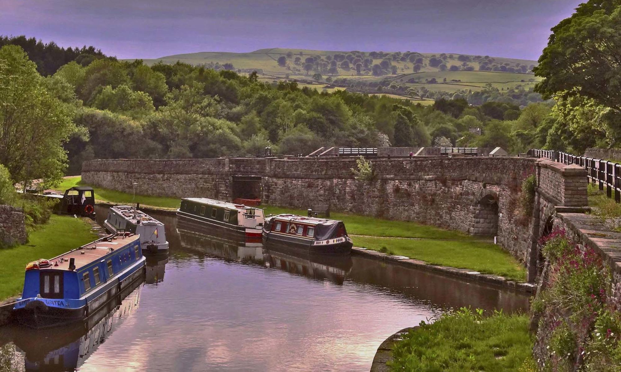
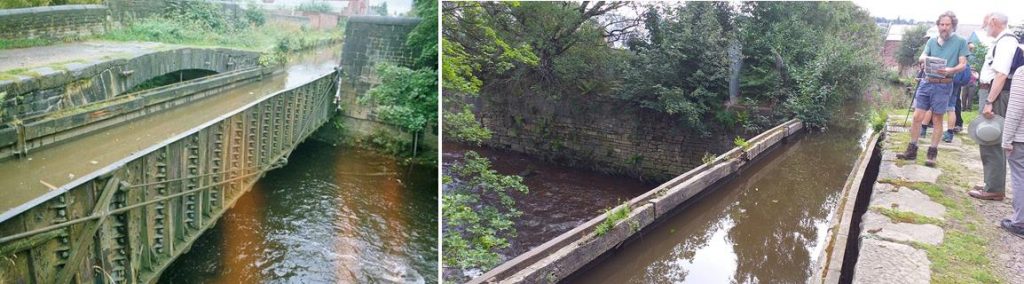
Our first stop was at Stakes aqueduct (also known as Stalybridge Aqueduct and Tame Aqueduct). The origin 4 arch stone structure was destroyed in the floods of 1799 when Tunnel End reservoir partially collapsed; it was replaced by a cast iron trough with a separate stone hump back bridge alongside carrying the towpath. This is grade II listed and can claim to be the worlds oldest working navigable iron aqueduct. The trough was assembled from flanged cast iron plates and was reinforced in 1875 due to concern about it’s strength. On the offside, wrought iron trusses were fitted and connected to a support beam mid span, the other end of this beam is supported from the hump back bridge by a tie rod and spreader plate.
We were now approaching Staley Wharf and Carolyn Street in Stalybridge, head of navigation until 2001. Stalybridge centre was one of the last sections of the canal to be restored, work starting in 2000. There had been an idea previously to divert the canal around Stalybridge using the River Tame. Armentieres square , the site of lock 6, was a car park and Stalybridge Sport centre had been built across the line of the canal and lock 5. However the sports centre was demolished in March 2000 and it was decided to reinstate the original line of the canal.
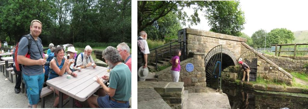
A new bridge had to be constructed under Carolyn Street, with lock 4 immediately beyond. Here a new lock had to be constructed slightly to the south of the original as a garage site extended over part of the lock.
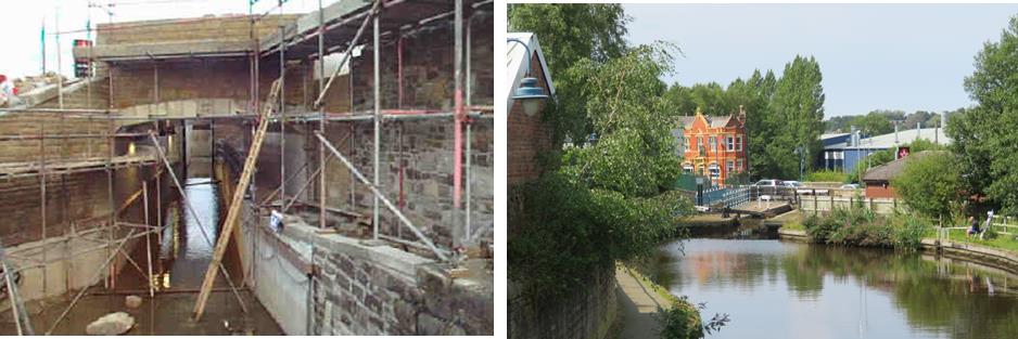
Right: Looking back to lock 4W the head of the original lock can be seen to the right of the new lock
Much of lock 5 was found to be intact, it had been infilled to make a small car park at the rear of the indoor sports centre, even an original sluice paddle gate had survived being buried for 30 years. Beyond here the canal had been infilled to the level of Back Melbourne Street and this had to be excavated and a new bridge built. Next is Melbourne Street Bridge, an original bridge which had been infilled, here the infill was removed and a new concrete channel laid. Immediately beyond this a new bridge was constructed leading to Armentieres Square and the new lock 6W.
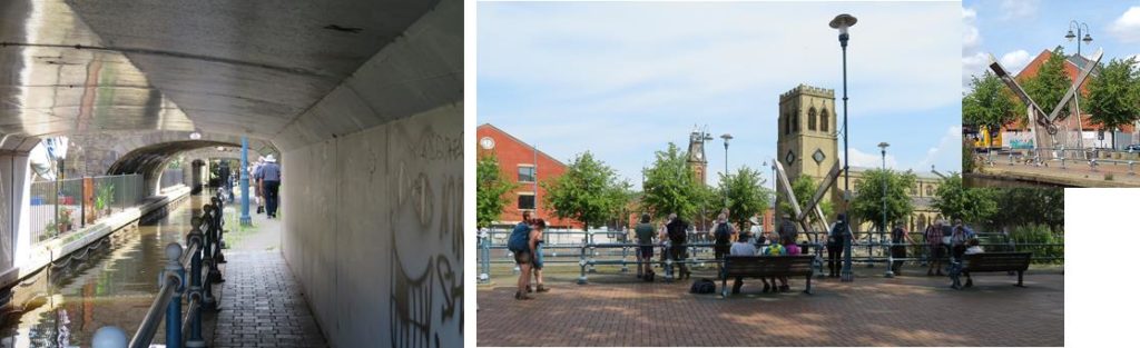
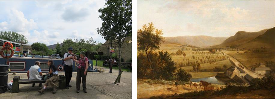
Right: Testing the seats at the side of lock 6W in Armentieres Square structure beyond the lock is a lock gate sun dial
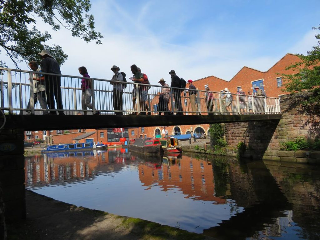
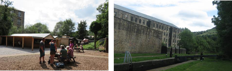
We continued through Stalybridge, past Tesco to lock 7 where we left the canal to reclaim the cars and drive to the Allotment Café at Mossley. Previously the Flying Teapot this is a hidden gem producing delicious food, some of which is grown on site, and was thoroughly enjoyed by everyone. It is also conveniently next to Woodend Mill, a great place to start the afternoon walk.
Built circa 1830-40 Woodend Mill is a near complete example of a first generation integrated cotton mill site, where both weaving and spinning processes took place, previously the two processes had been done on separate sites. Beyond here the canal becomes rural, quite a contrast to the morning’s walk.
After crossing the restored Royal George Aqueduct we passed the Royal George Mills. Built in 1786 the Mills had latterly specialised in producing taper hammer and technical felt but closed in 1999 and were converted into an attractive housing complex.
A pub now stands on the site of the next mill, Frenches Mill. By perusing old maps and a painting of the mills we worked out that the marina at the side of the pub is on the site of the old mill dam.
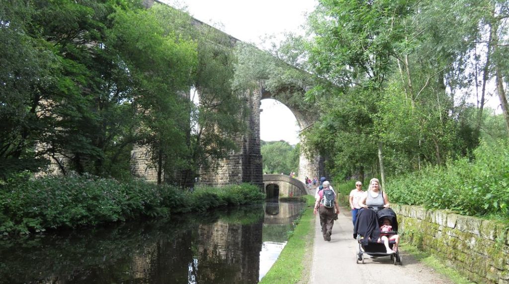
Approaching Uppermill High Street Bridge, which leads to lock 21, had to be lengthened because of road widening. This is another bridge with no towpath so walkers have to cross the main road to regain the canal. Uppermill was the first section of the canal to be restored, rejuvenation of the canal and town went hand in hand and it is now a very popular tourist destination. At the far end of the town the impressive Saddleworth Viaduct crosses the canal. Beneath this the canal crosses the River Tame on Old Sag aqueduct. This developed a sag soon after construction. During restoration it was relined with a lightweight concrete channel to make it safe but the sag was left untouched.
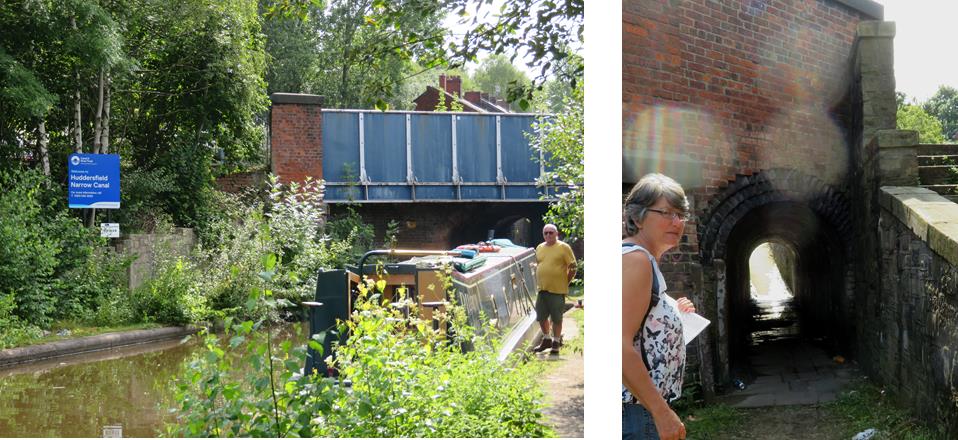
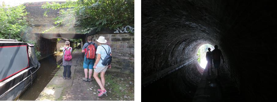
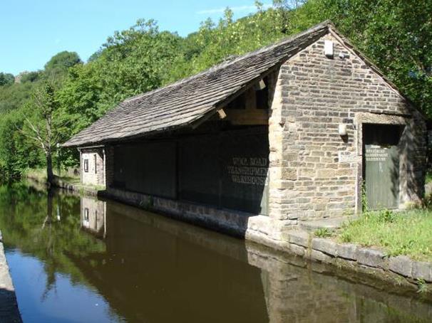
Next is Wool Road Basin with it’s transhipment warehouse (now the home of the Huddersfield Canal Society) that served the woollen mill behind (now converted to housing). Passing under the new road bridge and excavated Wool Road bridge we climbed Diggle locks, stopping after lock 28 to find the unusual pedestrian tunnel that was built under the canal to allow mill workers to cross from their cottages on the south side of the canal. The tunnel has a 90 degree turn in it giving very little light at the corner. With stone underfoot this can make it quite treacherous and due to the rain prior to the walk it was unfortunately deemed unsafe to explore on the day.
Refreshments were now calling and we hastened to Grandpa Greene’s Ice cream parlour next to lock 31 for a welcome break before the short walk to Standedge tunnel.
We had seen just 3 boats moving on a sunny day in August, it is a shame that so many boaters are put off cruising this beautiful canal because of the number of locks, but it was great to see the large number of people walking and enjoying the open areas alongside the canal.
Many thanks to those who turned out early to ease a fairly complicated day of car shuffling!