This walk was dedicated to the memory of Ian McKim Thompson MBChB, a much missed friend of the BCN and BBHT.
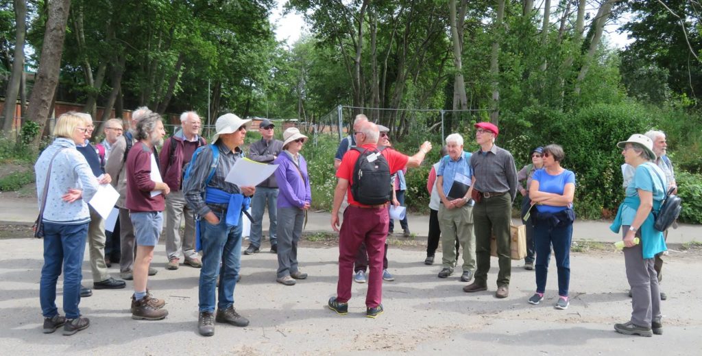
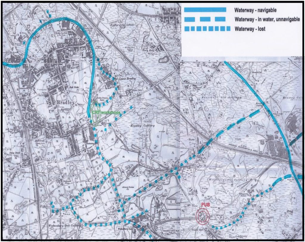
What is now the Bradley branch was originally part of Brindley’s Main Line (now called ‘The Old Main Line’) of 1772. When the line was straightened with the building of Coseley Tunnel it became the Bradley arm and a new section was also built with 9 locks taking it down to the Walsall Canal. It is currently navigable as far as the Bradley workshops, from there it is a restoration project. Dave Pearson, the local IWA branch deputy chairman and BCNS representative kindly accompanied us on the walk, explaining the restoration along the way.
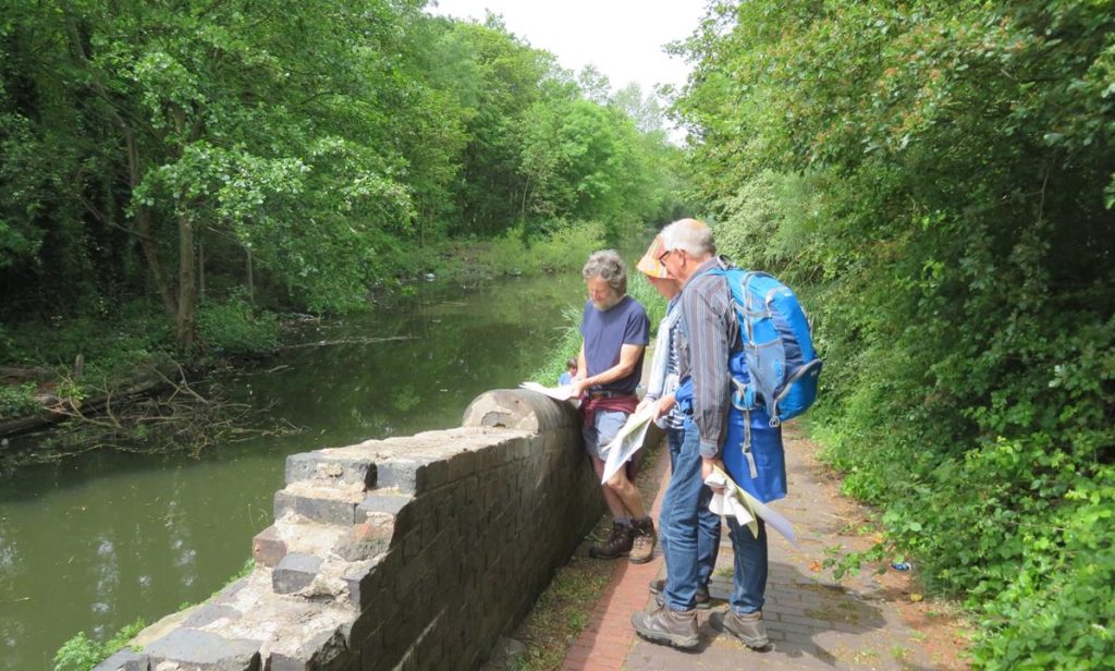
Before heading for the canal Paul and Kathy presented us all with a map of the canals/lost canals in the area which helped immensely in understanding all the loops and arms, some of which can still be seen, and interesting details of the walk. They also set the challenge of finding as many different makers marks on clay capping stones as possible (with prizes).
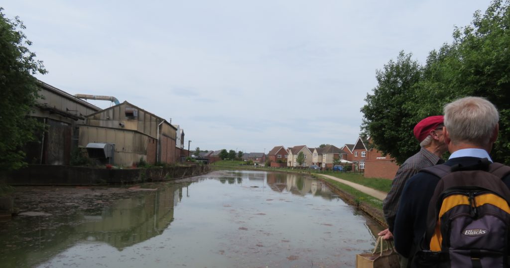
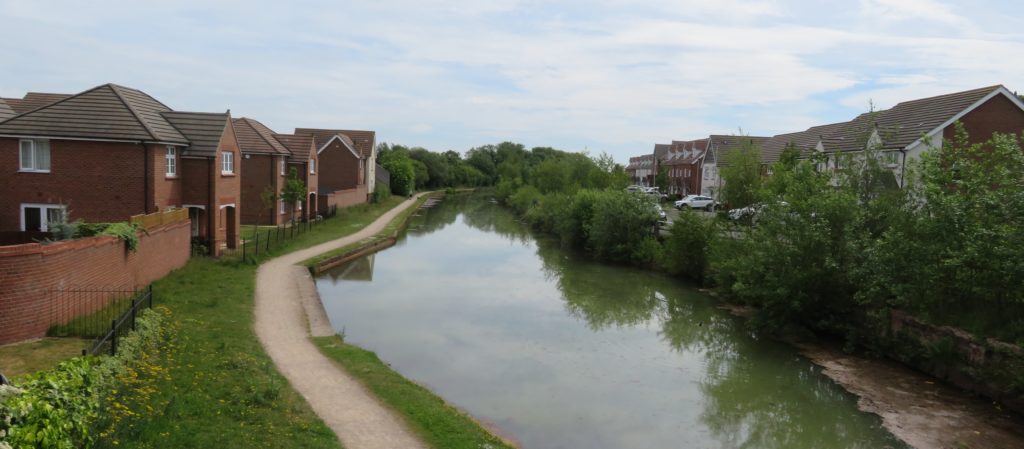
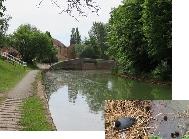
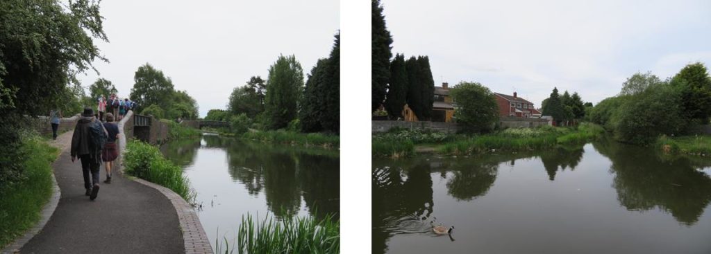
We joined the Bradley Canal at Glasshouse Bridge, part way along the navigable section of the canal. A few years ago it was a struggle to boat here because of weed growth. Much work has now been done to improve it, dredging (including lifting out a flattened, but complete Ford Escort), clearing the banks, installing Nicospan on the offside and seeding with wildflowers behind it to create an attractive bank and improving the towpath. Mooring rings are also planned to be installed. In the heyday of the canals this whole area was full of industry—Paul had counted 12 iron works and 128 coal mines and shafts! There is now much new housing and redevelopment in the area.
After passing under Pot House bridge, a blanked off section of canal can be seen ahead, this was the original line of the canal, a loop which served Wilkinsons Ironworks, which was subsequently straightened. Beyond this section Bradley Pumping Engine stood. This pumped water from local mines into the canal, electric pumps still do this, a mutually beneficial agreement with the successors of the NCB.
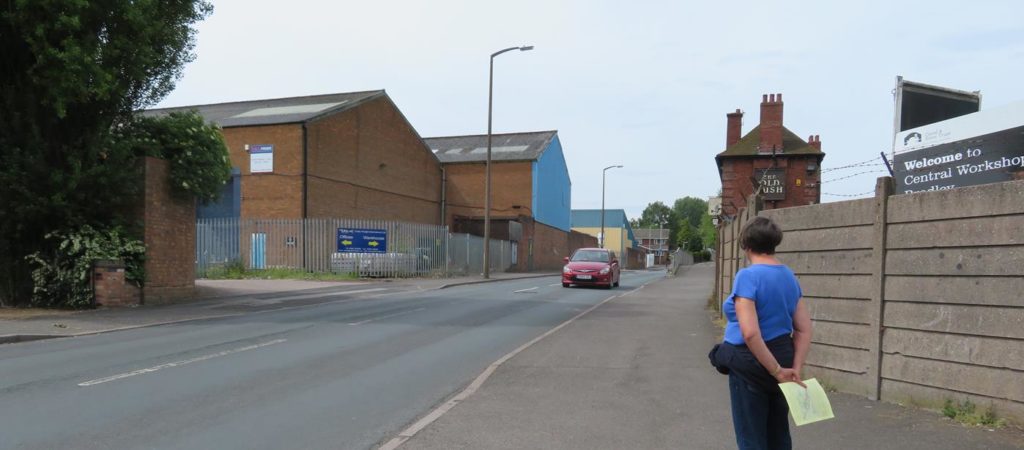
Immediately after Bradley workshop is the major obstacle of restoration. Across a busy road, on the line of the canal stand large factory units owned by CRT. The lease is nearing the end on these so there is the possibility of knocking these down and restoring the original route of the canal. Failing this there is an area of open land to the side which the canal could be diverted through, however this would entail building an embankment which would be very costly.
From the back of the factory the line of the canal runs through what is now an open green area, although it has previously been an area of mining, industrial wasteland and a council tip. It is known to be contaminated, another problem for restoration. Here there had been another loop in the original main line, we followed the later straightened line to the top of the 9 locks which led down to the Walsall Canal.

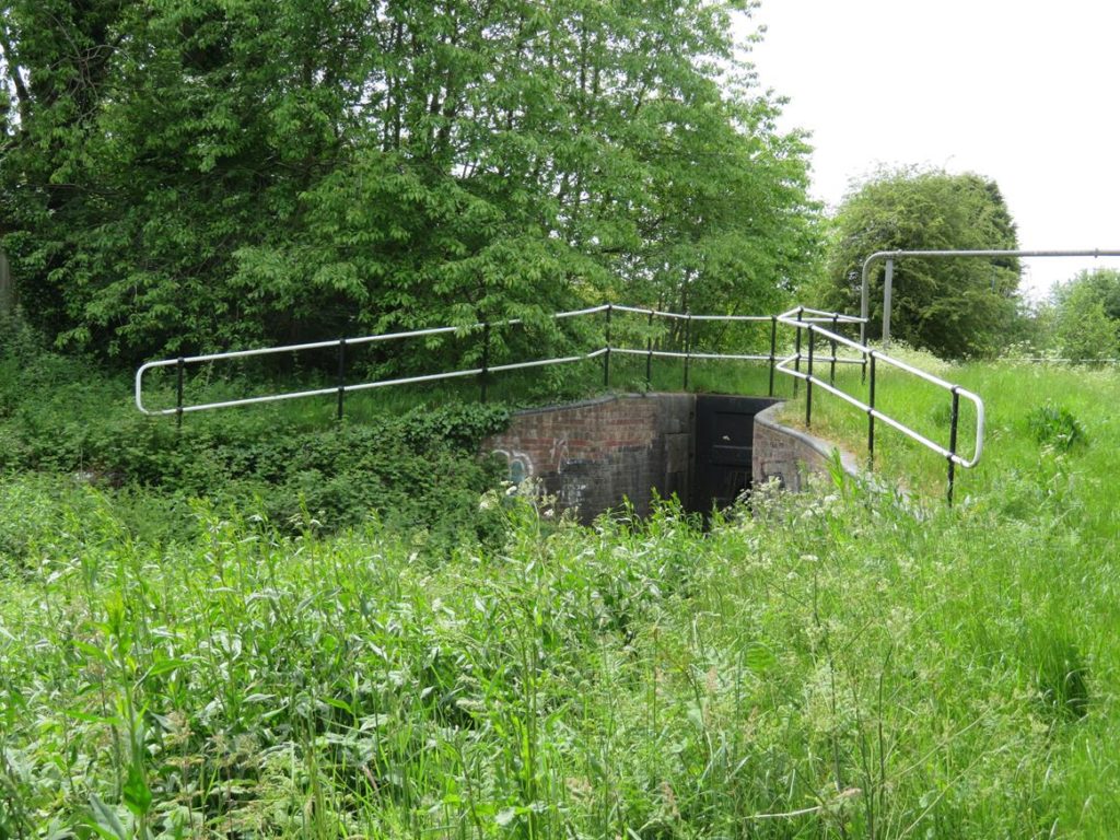
The top flight of 6 locks can’t be seen but were simply buried and are thought to be in quite good condition, prior to restoration the chambers would have to be dug out, inspected then filled in again to maintain stability whilst awaiting water and lock gates.
Another problem in this area is local resistance to the restoration as some residents have ‘extended’ their gardens into the canal corridor.
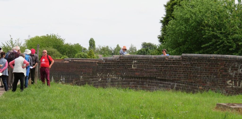
After these locks is a partly buried bridge, which carries a busy A road. This has recently been inspected, it is fairly certain that the abutments are still good and the arch may be serviceable. Below the bridge the canal is overgrown but intact, with the bottom three locks intact and culverted.
This final section of the Bradley Arm is tree lined and feels surprisingly rural, it joins the Walsall Canal at Moorcroft Junction. After a bit of clay capping stone inspection by the more competitive members of the group we set off south towards the Gospel Oak branch.
The Gospel Oak branch leaves the Walsall on the offside and is still in water (not navigable) for the first part of it’s length. It is hoped that residential moorings can be provided on this length. A path then follows the approximate line to the branch end through a green corridor. This brought us out close to the Gospel Oak pub where we stopped for an amazingly generous lunch deal.
Happily replete we headed back to the Wednesbury Oak loop and then retraced our steps back to the start of the walk, seven out of the possible eight capping stones having been found along the way.
This is a fascinating area, full of history and we were very fortunate to have two such knowledgeable guides in Paul and Dave. It would be nice to see more boats venturing onto the arm, which with the recent improvements should be an absolute doddle compared to a few years ago. Even better would be to travel down a restored link to the Walsall canal which we hope to see come to fruition. Hopefully this would also lead to improvements along the Walsall canal, which has a surprisingly green and well kept towing path but suffers badly from weed growth in the channel.
Many thanks to Dave for accompanying us for the day and being a font of knowledge and to Paul and Kathy for their organisation and detailed research of the area and making the day so interesting.