RIGHT THEN! Walks start again

Stockport Branch Canal Walk 22nd May 2021

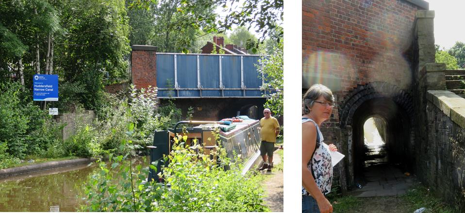
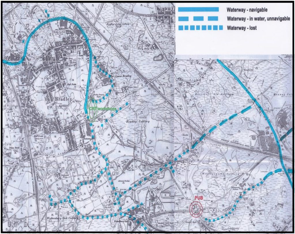
The Stockport Canal branch of the Ashton canal opened in 1797. 4.2 miles in length with no locks it was very busy from the start. It was mainly used to transport coal from the collieries in the Ashton and Oldham area to many mills and factories along its length as well as coal for domestic use. It also carried grain to Albion Mill at Stockport Basin and raw cotton to the mills, general cargo and finished goods. In the early years there was a passenger carrying service between Manchester and Stockport.

It had a long period of decline and by the 1920s there was very little trade although factories and mills used it as a water supply. It was last used by commercial traffic in the 1930s, then the canal was left to deteriorate. The length from the start of our walk into Stockport, initially owned by Stockport Council, has largely been built over or incorporated into gardens whilst the length in Manchester Council ownership has been maintained as a footpath/cycleway with very little obstruction to restoration.

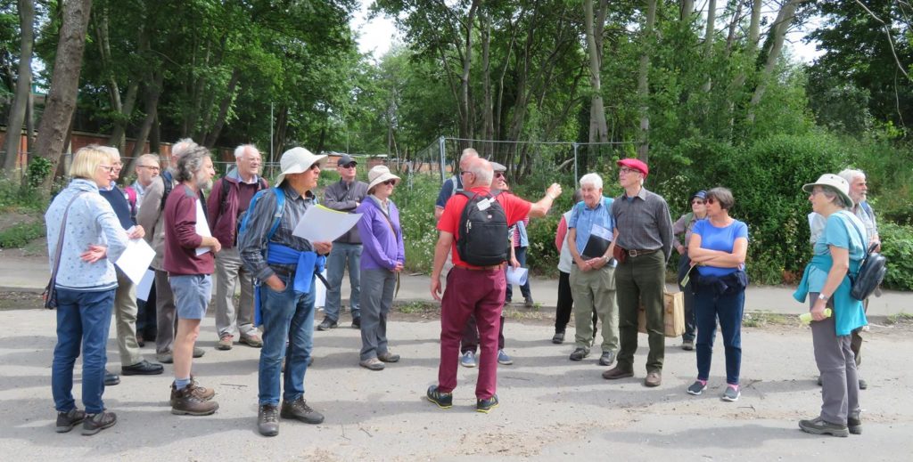
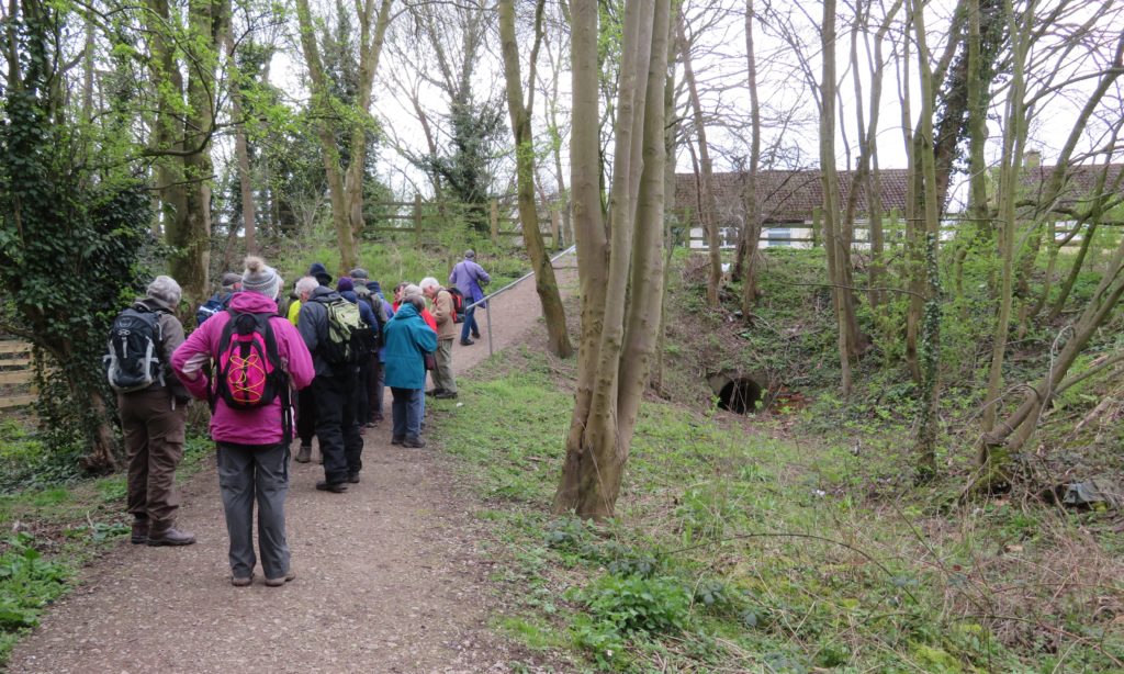
We were made very welcome by the Manchester and Stockport Canal Society with Roger Bravey,  Society Chairman leading the walk and explaining the society’s aims and aspirations.

Another member of the society, Graham Burns, was a font of local knowledge. He had been a volunteer at Bugsworth basin in the early days of the restoration and involved in the Ashton restoration so there was much reminiscing with our group.

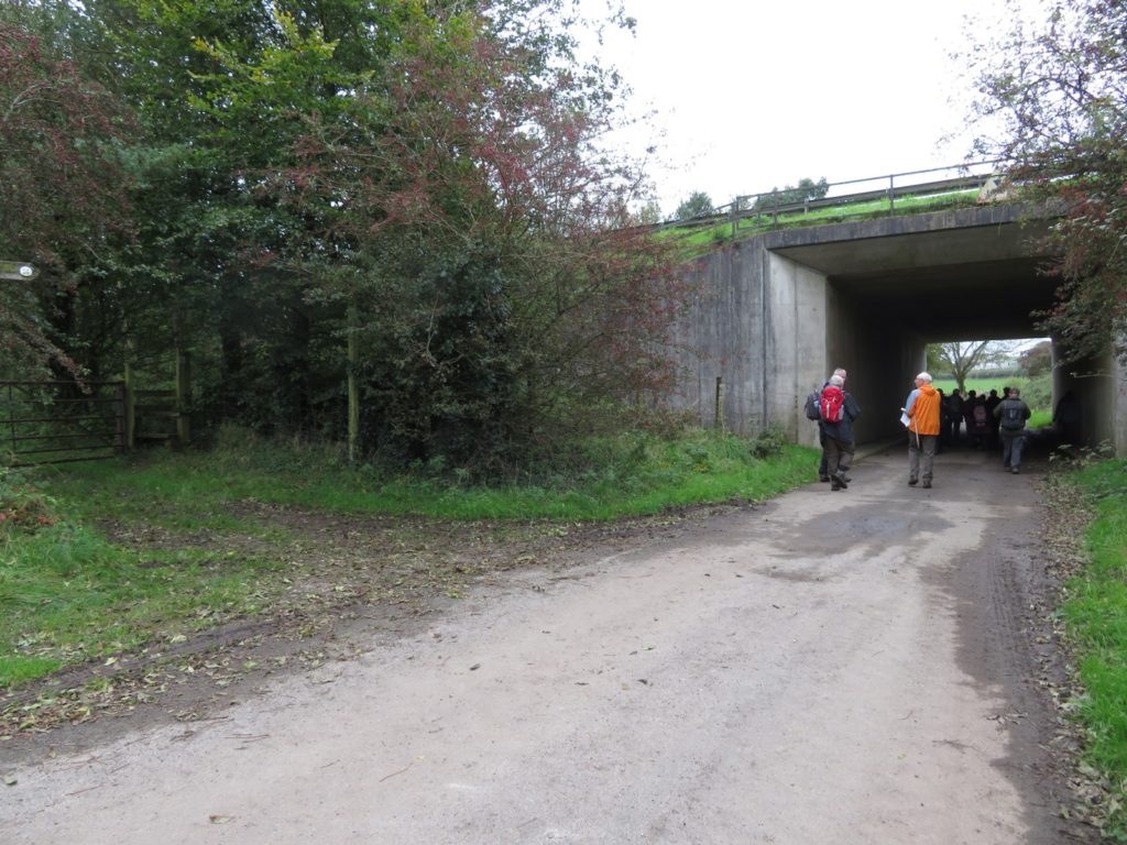
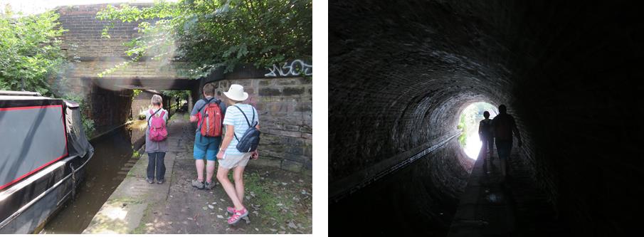
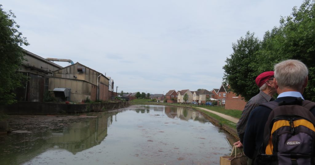
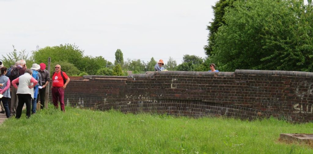
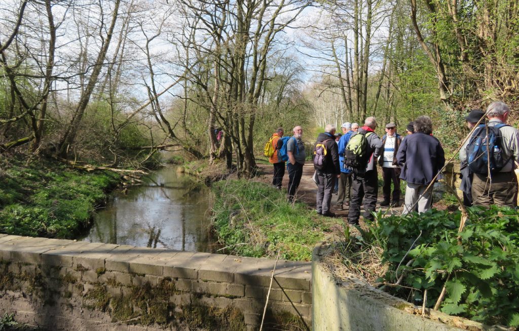
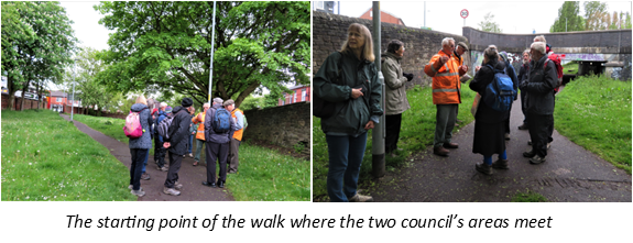
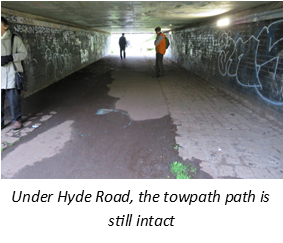
After our enforced break it was good to hear ‘Right Then!’ again and after some easing of unused joints Roger led us just a short way towards Stockport under the two bridges of Hyde Road to the start of the walk.

This is the point where Manchester City Council and Stockport Council meet. Stockport council had not shown an interest in the canal, allowing it to be filled in and built over. Roger explained that there will be opportunities in the future as buildings go out of use to try and get the line of the canal incorporated into future developments – there is one building closure anticipated and the land is likely to be used for social housing, an ideal opportunity for the society. In other places detours could be made.

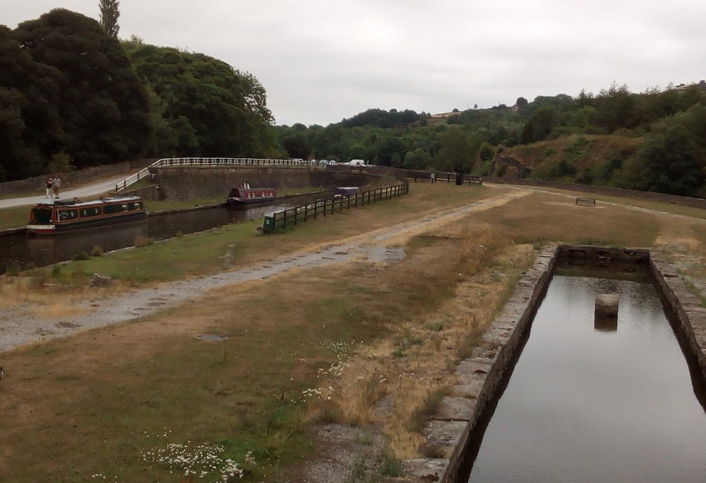
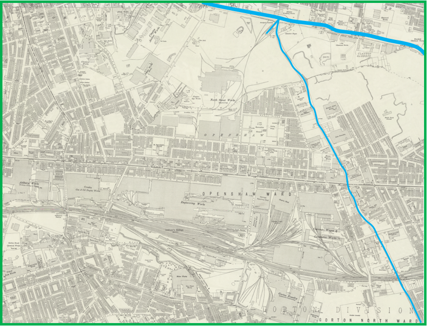
Thankfully Manchester Council had quite a different attitude and the line of canal to Clayton Junction is protected although it is infilled and currently in use as a footpath and cycleway. So this is the length of canal that the society are currently concentrating on.

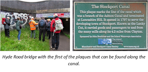
The plan is to start restoration at Clayton junction and gradually work towards Gorton Reservoir. The  open space in which we were standing at this point is large enough to take a winding hole as restoration of the canal continues towards Stockport. We retracted our steps under the two Hyde Road bridges after stopping to read the first of the plaques which have been installed along the line of the canal.  

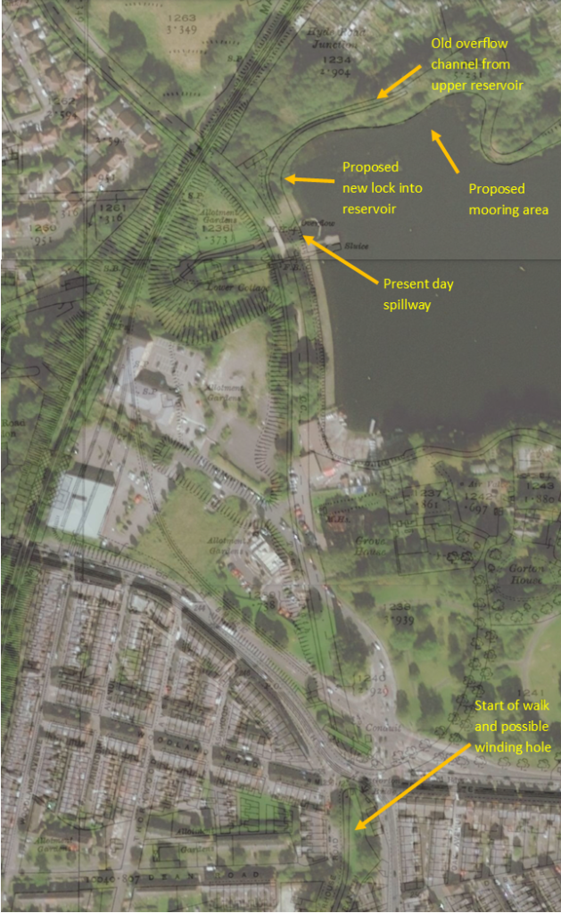
Next stop was at Gorton Reservoir. The reservoir was opened in 1825/6 to provide drinking water for Manchester and the canal ran along the head bank.

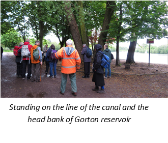
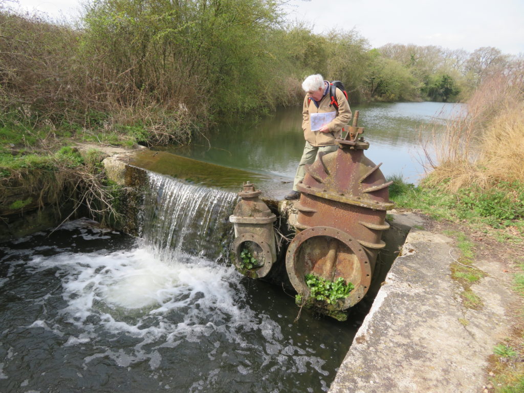
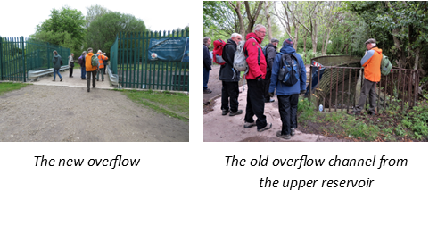
No longer used for drinking water Gorton Reservoir it is now the home of Debdale Outdoor Centre who operate a lot of watersports on the reservoir. It has a modern overspill weir crossing the line of the canal, because of this and for safety reasons the canal couldn’t be re-instated here. The idea instead is to build a lock to access the reservoir where there would be a marina – there is already a suitable area not used for watersports that would be ideal.

Debdale Outdoor Centre are keen for this to happen and it would provide a very welcome and much needed safe stopping point for boaters using the Ashton Canal.

In order to continue restoration towards Stockport another lock would need to be built at the other end of the headbank to lock back into the canal.

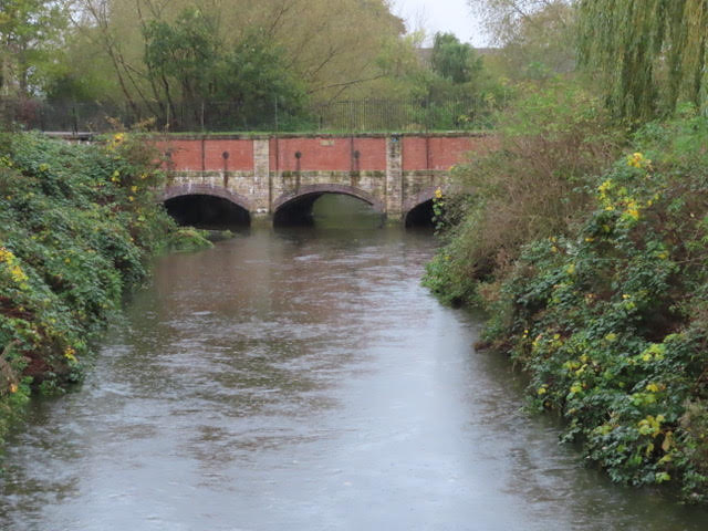
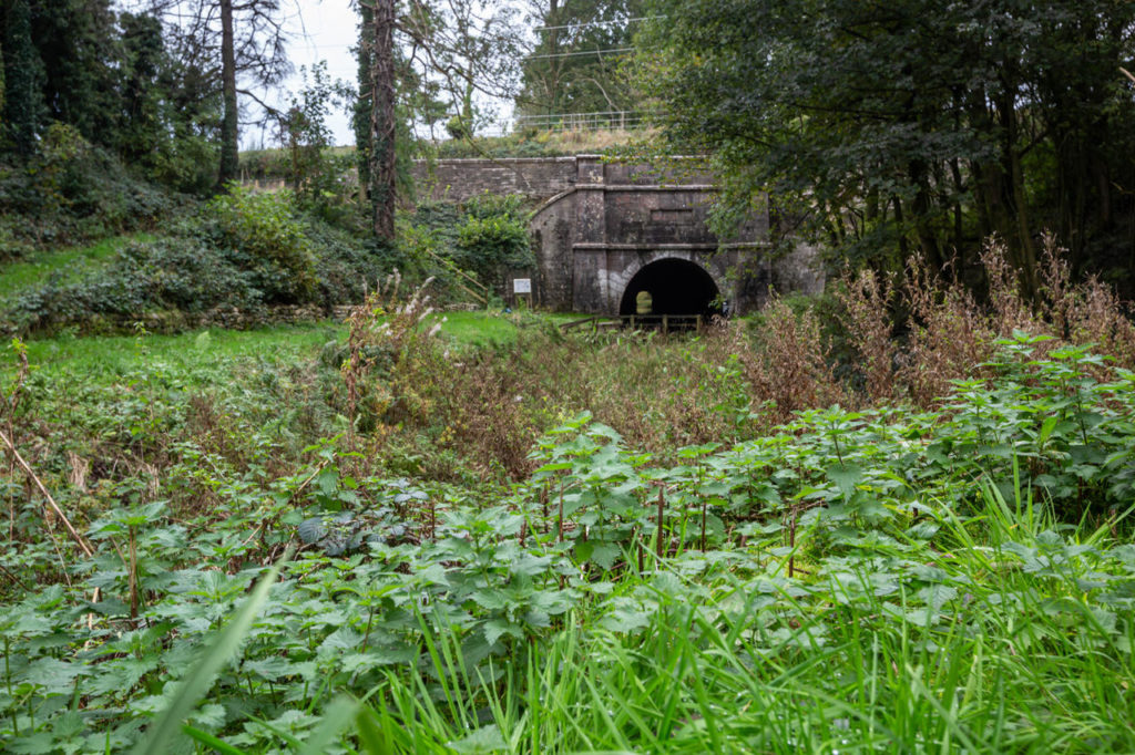
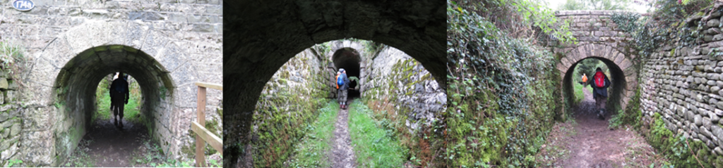
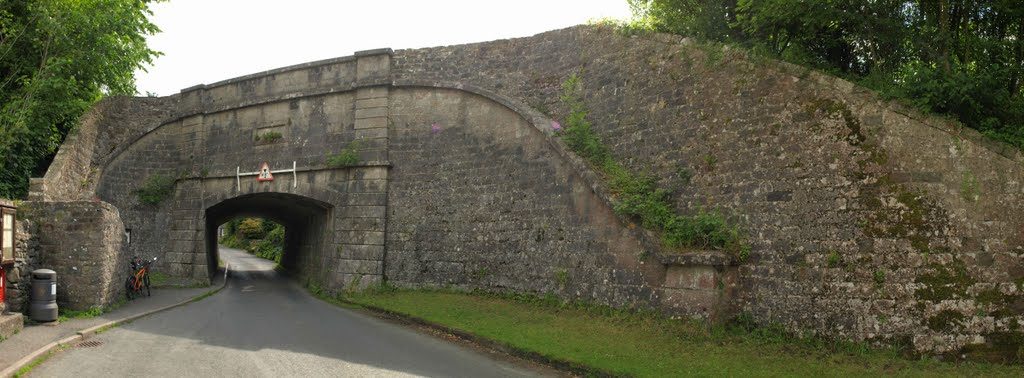
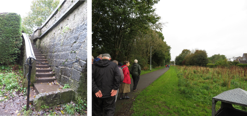
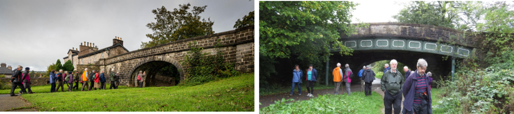
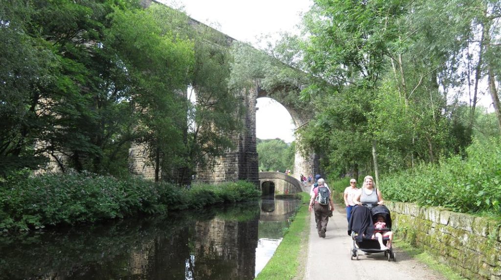
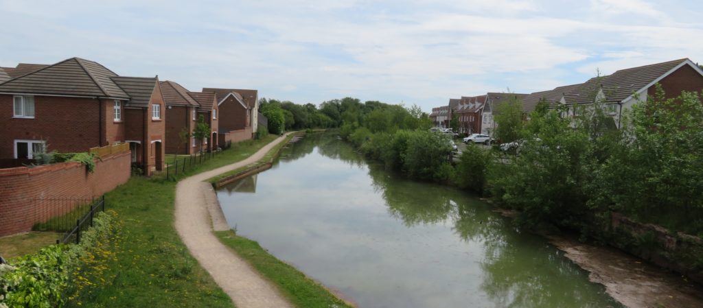
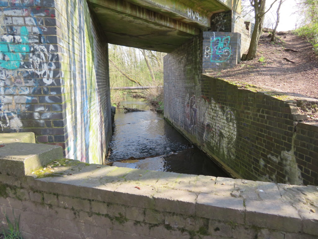
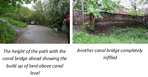
We now set off down the ‘Yellow Brick Road’, possibly so called because of local houses, now demolished, which were built of yellow brick. Although the line of the canal has been protected it is not only infilled but the level is now much higher than the canal which can be seen at the remaining bridges, all but one of which still exist, mostly in good condition some having indents where rollers for boat ropes were installed.

This obviously means that there is a huge amount of infill to excavate and remove. CRT have done a ground survey which largely came up clear with only a couple of small areas possibly having some contamination.

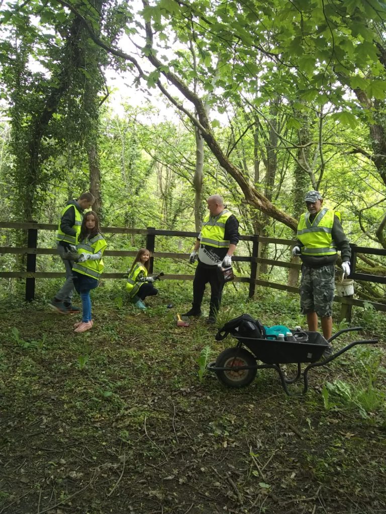
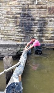
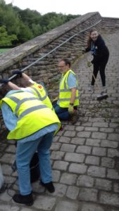
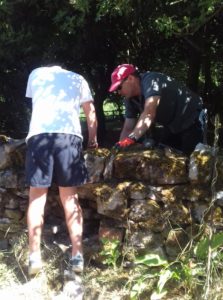
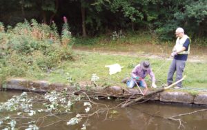
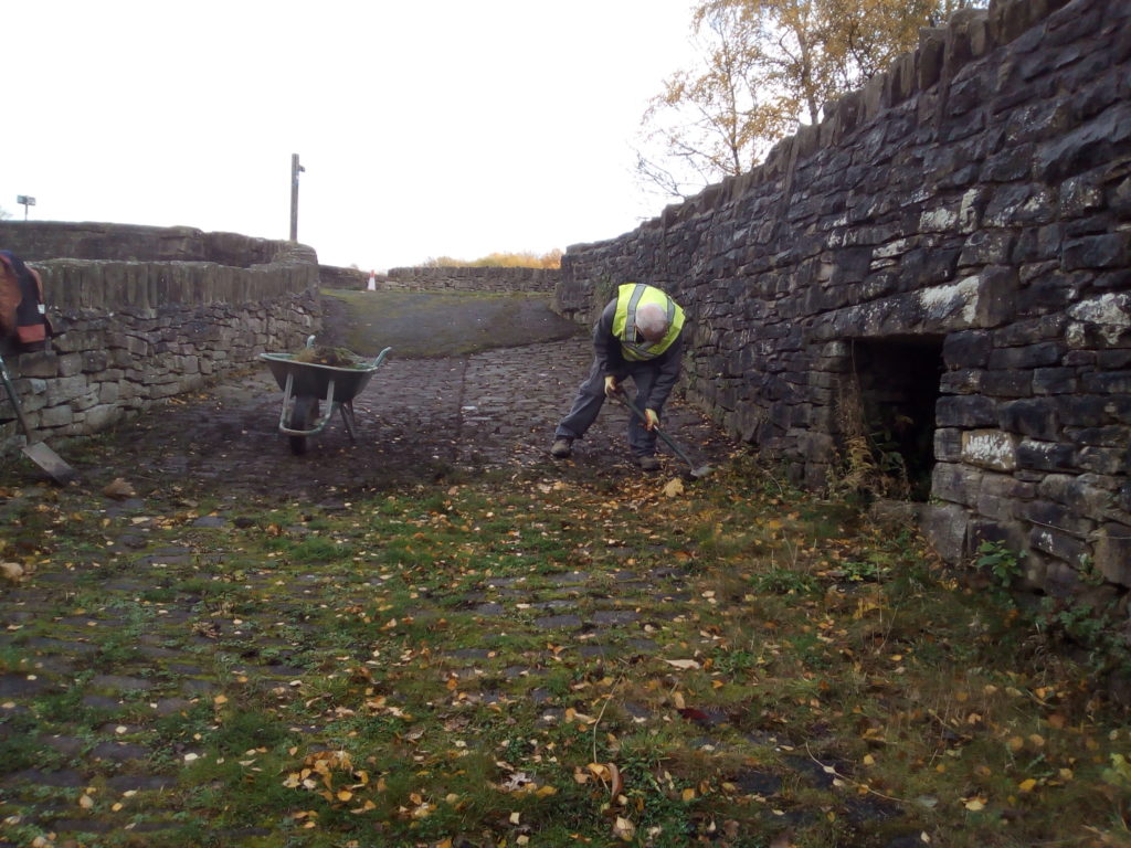
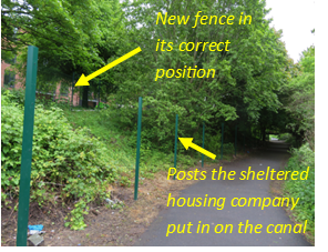
Prior to lockdown working parties had been concentrating on keeping the canal line clear of rubbish and clearing undergrowth. The Society also keep a keen eye on anything that might impede restoration, such as making sure that no services cross the canal – a possibility with the current improvement of cycleways where there are thoughts of installing lighting. We came across a line of metal posts and asked what they were, apparently some new social housing had installed fence posts along canal land and thanks to the society are now having to move them back onto their own land.

The society are also working hard to persuade local people that the canal would be an asset to the area – as the path is currently a very pleasant walk and cycleway with many trees along its length (many of which would have to be removed) this is quite a task. There is enough width to incorporate canal, towpath and a dedicated cycle path, possibly raised up from the towing path thus keeping walkers and bikes separate!

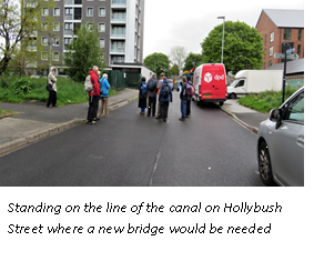
Footbridges will have to be installed where paths cross the canal. The only road bridge that will need building is at Hollybush Street but this comes with problems: the road is quite short and completely level, it is now a service road to relatively new flats meaning that the usual hump backed bridge is not going to be suitable. There are various options to be considered. 

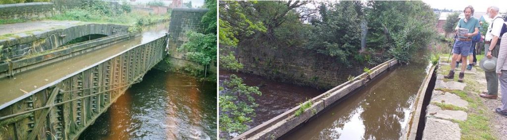
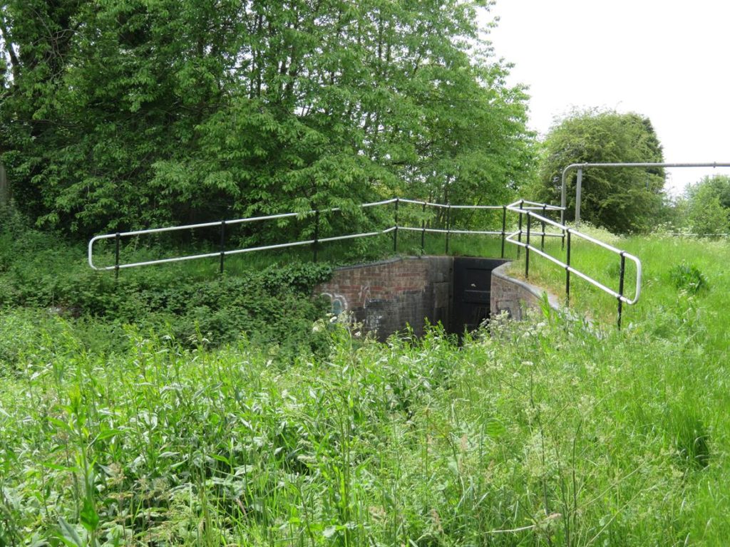
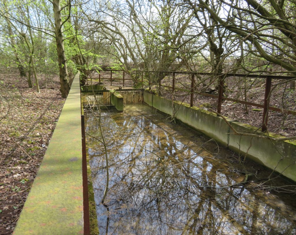
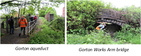
The canal crossed the Great Central Railway line on an iron trough aqueduct close to Gorton Station. The aqueduct is still in good condition, trees have been removed and a survey showed that it still holds water. A layer of soil has been left in the bottom of the trough to protect it.

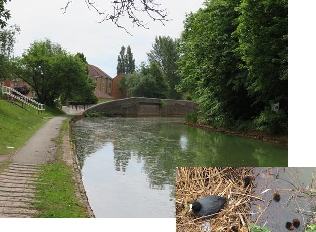
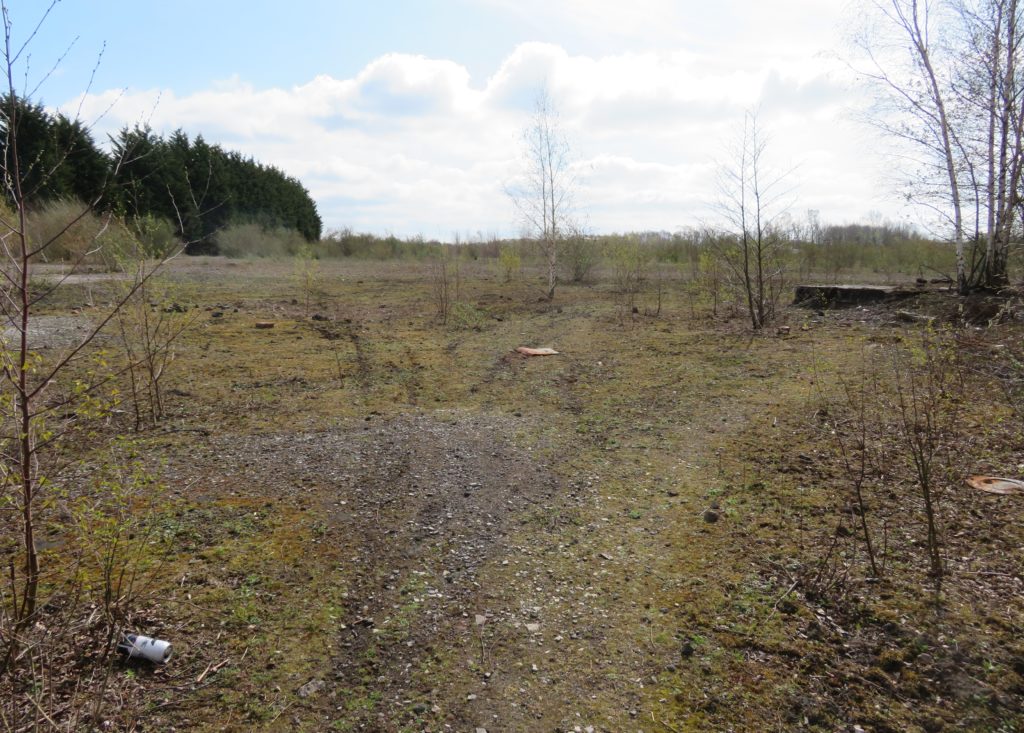
Just past Ashton Old Road, about half a mile from Clayton junction is another open area, this would be another ideal space for a winding hole after the start of restoration from Clayton junction.

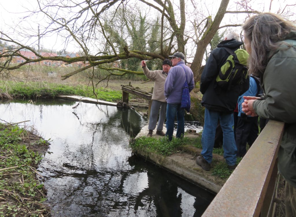
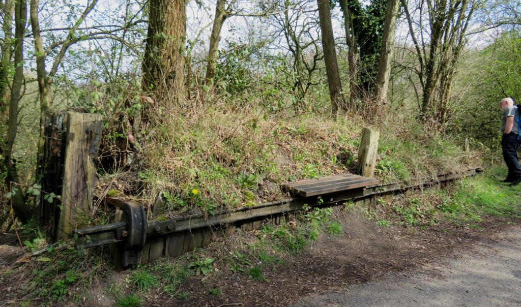
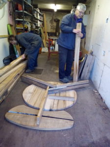
Remarkably, the bridge over the Gorton canal depot arm, with it’s carved head keystone, is still intact, although the arm and works are long gone and developed for housing. In the widening for boats to turn there are three sunken boats. The society would like to recover and restore one of these.

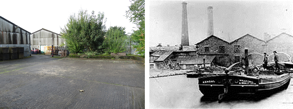
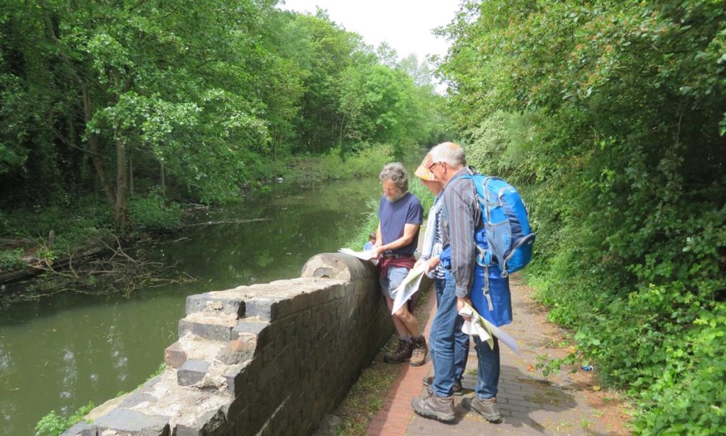
And so to Clayton junction where the start of the arm is still in water. There was another short arm off the Ashton Canal here which serviced the Armstrong Whitworth North Street Works. This had  railway connections to/from Armstrong’s and after cassation of traffic a gas works was developed on the west side.

 The following link gives further information on North Street Works:-

Historic map showing the railway serving industry and the canal. The canal is marked in blue, Clayton junction is at the top of the map.

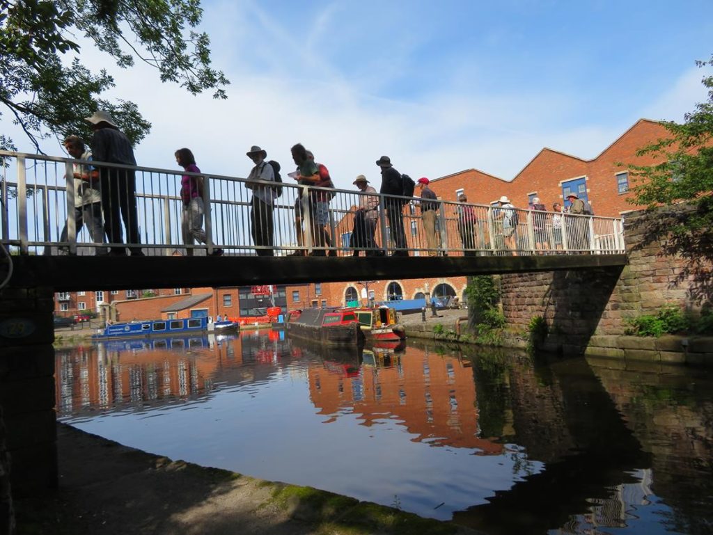
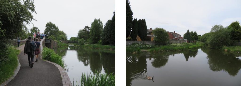
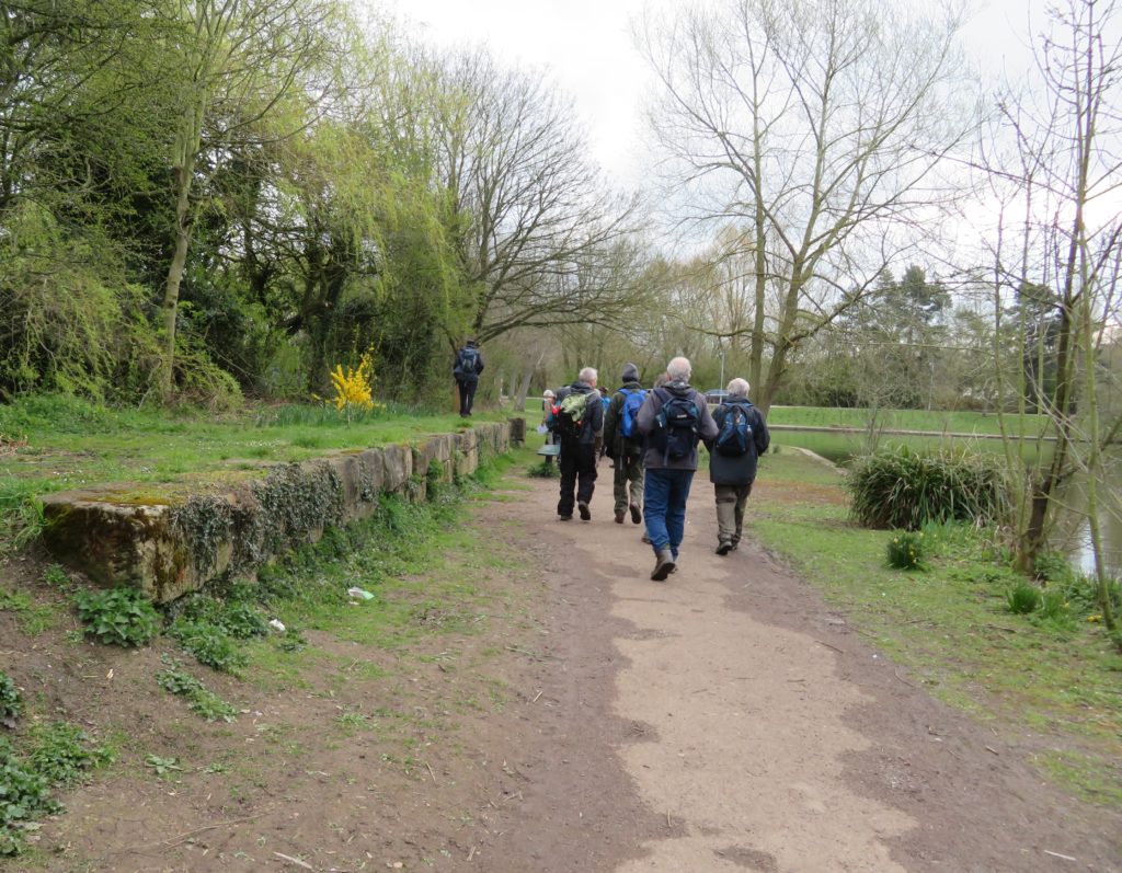
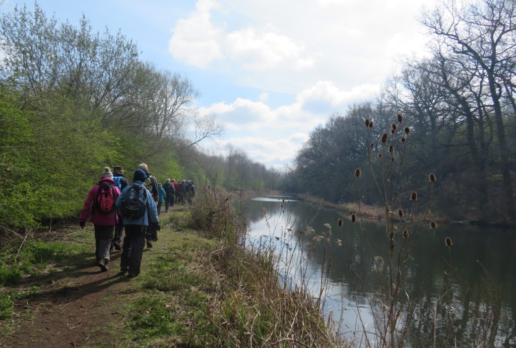
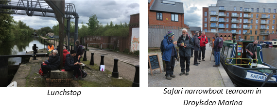
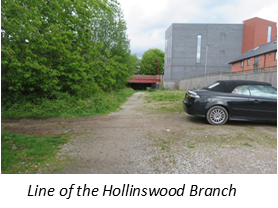
This was the end of the guided part of our walk (we found it so interesting we had spent two and a half hours on a mile and three quarters of canal, a record even for us we think!). Roger and his wife left us at this point while Graham and Liz accompanied us a short way up the Ashton to our lunch break at lock 11 next to the Strawberry Duck. Sandwiches were consumed to the accompaniment of water leaking around lock gates before we set off up the remaining locks towards Droylsden Marina. Here we were just in time to purchase hot drinks (and some delicious cakes) from ‘Safari’ the canal boat café based there, right at the point where the Hollinwood Branch would have carried on. There is a very short stretch of the line visible with a bridge still intact which you can peer into, the towing path, coping stones and wooden rubbing strake are still in place.

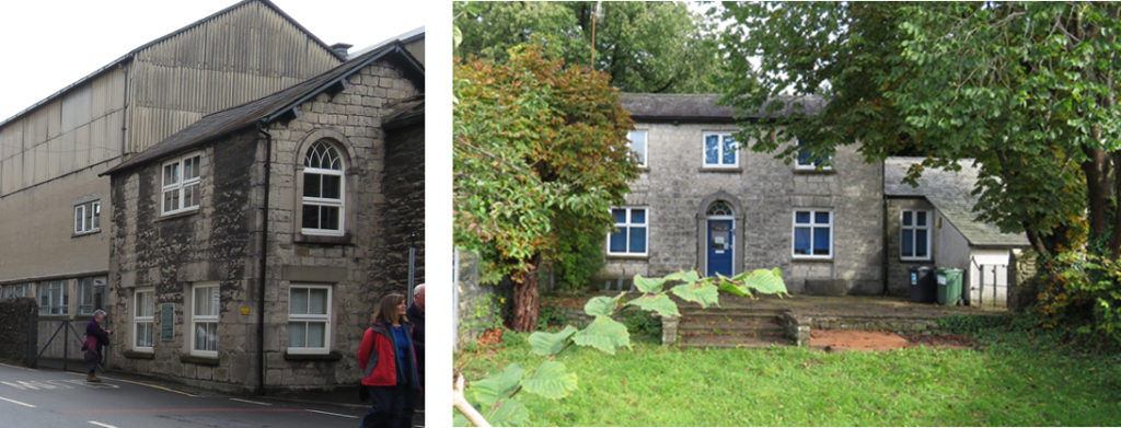
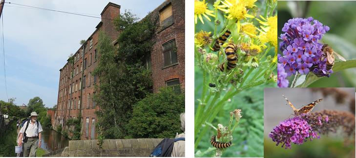
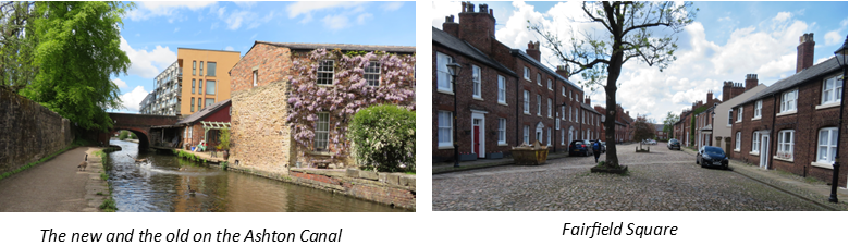
We were now onto the informal part of the day, Paul and Pauline had been studying their OS maps and spotted that instead of retracing our steps that we could complete a circular route back to the reservoir, starting by continuing up the canal towards Marple. After a brief but pleasant stroll up the Ashton, Andrew led us away from the canal up a footpath which emerged into Fairfield Square, all of the buildings of which are of Special Architectural or Historic interest. Fairfield Square is a Moravian settlement. Opened in 1785 it was planned and built by its own people. At that time it was self contained, even having its own doctors and fire engine. Now it accepts some housing association tenants. Their emphasis is still on Christian life and fellowship which shows in the atmosphere in the square.

From here we headed for Gorton upper reservoir from where there were several routes to return to the starting point and we split into groups to follow our chosen paths (although only two of us found the ice cream van!).

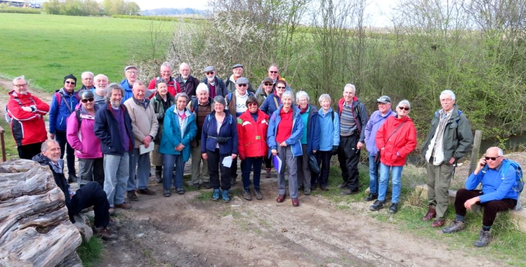
It was really good to be meeting up and be walking again and this was an excellent start. Many thanks to the Manchester and Stockport Canal Society for their time and the wealth of information. Thanks also to Paul, Pauline and Andrew guiding us in the afternoon.

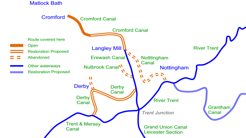
Next time out: Sunday 8th August, the Cromford Canal

November Walk – The Chesterfield Canal

The original intention had been to walk the stretch of the Chesterfield Canal from Retford to Clayworth, however, shortly before the walk was scheduled it was decided to finish after lunch at the Gate Inn, Clarborough as it was thought that the towpath from Clarborough to Clayworth might prove to be a bit tricky in the reduced length of daylight once the clocks had gone back.

A very select band of walkers met at the Gate Inn, Clarborough and transferred in one car to travel to the Churchgate Visitor Car Park in Retford. It started to rain as we pulled into the car park so we all climbed into full waterproof gear before making our way into Kings Park. Once in the park we walked along side the River Idle and as we neared the canal we crossed the river on a footbridge and had a good view of the three arch aqueduct which carries the canal over the river. We then continued a further short distance through the park to join the canal at Inkerman footbridge.

The three arched canal aquaduct crossing the River Idle as viewed from Kings Park
The iron lattice Inkermans footbridge

Once on the towpath we turned left and proceeded in the direction of Retford Town Lock. In a short distance on the canal side opposite we saw a former warehouse which still bears the name Fletcher and Sons in faded letters. It turned out that the couple who converted the building into a private house were friends of Dave and Izzie’s who had visited the property before conversion had started.

The group pauses on the towpath, possibly to acclimatise to the very wet conditions, whilst Paul is already exhibiting significant signs of shrinkage

We then crossed the three arched aquaduct over the River Idle we had first viewed from Kings Park. The next noticeable feature we encountered was Retford Town lock which is the first narrow lock on the canal since the navigation left the River Trent at West Stockwith.

Just below the lock and just beside the towpath we came across The Bay Tree Cafe Bar, since we had by then already been walking for almost twenty minutes and it was extremely wet we thought we would set what we believe may be a IWPS/BBHT walks precedent by stopping for a morning hot drinks, snacks and a temporary dry. Teas, coffees and toasted tea cakes were ordered and thoroughly enjoyed.

A morning stop for teas, coffees and toasted tea cakes an BBHT walks game changer?

The shelter offered by The Bay Tree allowed an extract from James Roffery’s excellent book on the Chesterfield Canal to be consulted. The cafe is situated on what was originally the Corporation Wharf and the book recounts the story of how, in the late 19th century, the Manchester, Sheffield and Lincolnshire Railway Company erected gates across the towpath, to prevent pilfering from its warehouse on the wharf, and kept them locked. Retford Corporation brought an injunction for obstruction against the railway company and a legal wrangle began; the Corporation claiming the towpath had always previously been open and the railway claiming they had always had the right to refuse access. The Corporation produced evidence that the local baptists had regularly held open-air baptisms near Town lock. Apparently those being baptised were totally immersed in the canal, after which they were taken into the lock keeper’s cottage to get dry and have a hot drink. The Corporation won the case and the towpath has remained open ever since but apparently according to Roffery “The open-air baptisms were brought to an end by boatmen, who expressed their annoyance if they were delayed in language that did not suit the occasion.”

After we departed The Bay Tree we found, close by, one of the excellent information boards we had spotted previously along the towpath. This board included an explanation of how it was largely thanks to the actions of the Reverend Seth Ellis Stevenson that the final route of the Chesterfield Canal came through Retford. The original route planned for the canal in 1768, did not include Retford but instead it was to go to Bawtry. However, when Seth Ellis Stevenson learnt of the plans he began to work hard to bring the canal to Retford including, writing a promotional pamphlet, visiting influential land owners, talking to engineers and after many public meeting the route of the canal via Retford was agreed in June 1770.

The white building on the far side of the bridge is the Packet Inn and the imposing brick building in the foreground is Grove Mill

The Packet Inn was the terminus for the weekly packet boat from Clayworth that brought villagers and their produce to Retford Market. The Grove Mill building was originally used as a malthouse but was converted to a flour mill around 1900. The canal provided fuel for the boilers, the grain and then took the finished flour to West Stockwith for onward transport.

In 1978 British Waterways were carrying out dredging work close to the mill when a chain was dredged from the bed of the canal and attached to the chain was the wooden lid of a culvert. The water in the canal between Retford Town Lock and the Whitsunday Pie Lock poured out leaving several boats high and dry. The incident received wide coverage in the media and caused some embarrassment to British Waterways who became known as the organisation ‘Who Had Pulled the Plug Out”

Whitsunday Pie Lock is the last wide lock on the journey up the canal from West Stockwith and is possible the most well known lock on the canal because of its unusual name. There are various theories regarding the origin of the name including a neighbouring farmer’s wife baking a huge pie on Whitsunday to celebrate either the completion of the lock or the end of a long stoppage but more recent research has shown the name existed before the lock was built.

Whitsunday Pie Lock (photographed on the recce walk when it was not raining)

Bridge 61 Bone Mill bridge has a slightly flattened and distorted shape to its arch but we were puzzled by the additional courses of brick which had been added to the parapets on both sides of the bridge.

Bridge 61 Bone Mill bridge (again photographed on the recce walk)

The Gate Inn was the end of our short walk where we were very pleased to meet up with Ian Edgar who had joined us for a pleasant lunch and interesting discussions on canal walks and the people who go on them.

Many thanks to Mark and Ruth for organising the walk and for writing this article.

Lancaster Canal Weekend Away

Our weekend started with an interesting illustrated talk on the Friday evening by the Lancaster Canal Trust about the history of the canal and the restoration. 

Running from Preston to Kendal, by 1797 the Lancaster Canal was operating as far as Tewitfield. Work started north of Tewitfield in 1813 and reached Kendal in 1819. This was much needed in Kendal and was of immediate benefit to the town which thrived from then on.  Known as the ‘Black and White Canal’ because coal was brought in and limestone taken out, a passenger service also ran between Preston and Kendal  – the boats managed an amazing 10 mph – loyal customers using it even after the advent of the railways.

In 1941/42 the LMS railway, who owned the canal, closed the top half mile of the canal in Kendal , the LMS tried to close the remainder but as the canal still served the gas works in Kendal this failed.  However this supply was transferred to road in 1944 and commercial traffic ceased in 1947. The canal officially closed in 1955. It had always suffered leakage due to the underlying limestone and due to the leakage it was drained north of Stainton with the two miles into Kendal being filled in. A section at Burton was also drained with a pipe taking water down to Tewitfield.

The Lancaster Canal Trust formed in 1963 with the aim of preventing the northern extension of the M6 closing the navigation north of Carnforth. When this failed the aim of the society became to re-open the canal between Tewitsfield and Kendal. The M6 cuts across the canal at 3 points but it is possible to take the canal underneath, one could be done as a bore but the other two would need excavating and piling, this would have to be done one lane at a time. This would be a multi million pound project.

Saturday’s walk started in Holme. Holme is one of a number of places along the Lancaster Canal where coal was once brought by canal barge to a wharf and then converted to coke for use locally. The Coke ovens are now in a garden on the offside of the canal and the owner allowed the group into his garden to view these early beehive shaped ovens.

From Holme it was a pleasant mornings walk to Crooklands. This section of the canal is in water, running through open countryside although the M6 inevitably runs close by.  After stopping at Crooklands for lunch David Gibson, secretary of the LCT, joined us as guide for the afternoon. At Crooklands Wakefield Wharf served the gunpowder factory C.W.H. Wakefield and Co. at nearby Gatebeck, a small horse drawn tramway was built to link the factory with the wharf and thence to Milnthorpe Station. From here the canal continues through pleasant countryside for another couple of miles to Stainton aqueduct.

Unfortunately, the towing path here is closed as CRT are still working on the aqueduct which was damaged in the floods of 2015 (hopefully this will soon be reopened) and the group had to detour via the road. However Mark and I had an unscheduled detour and were at least able to view the aqueduct from the river below.

Stainton aqueduct after the floods of 2015 and today

Soon after this we reached the ‘first furlong’, running between bridges 172 and 173, where the society are currently lining the canal with a sandwich of geotextile and a high grade pond liner in between, covered in concrete blocks as a physical barrier to damage from above and to hold the liner in place against groundwater pressure. As can be seen the volunteers are having some problems with water getting underneath at the moment.

The start of the first furlong

The canal ran out as we reached Well Head Lane, this farm road runs under the A590 which cuts across the line of the canal. David explained that as this is a little used road mainly used by farm vehicles they are looking at the possibility of the canal using the bridge or sharing the access under the bridge, but both options are unlikely to be practical.

The path from the canal on the left, the A590 cuts across the canal corridor

Passing under the A590 we regained the towpath and were soon at Hincaster tunnel. The 378 yard long tunnel is a Scheduled Ancient Monument, the first ten yards at each end and the underwater section are all built of limestone, the rest is lined with approximately 4 million locally made bricks. The engineers were loath to use brick, believing that the structure wouldn’t be strong enough, it was pointed out that brick had been used successfully in tunnels further south and the tunnel became the first major brick-built civil engineering project north of the Mersey at that time.

Inside the tunnel you can still see the fixings for a chain or rope – allowing boats to be pulled through as an alternative to legging. To the left of the tunnel is the horse path with an impressive series of horse tunnels, two at this end and one at the far end, presumably to give farm access over them.

Approaching Hincaster tunnel
The horse tunnels

Continuing towards Sedgewick, it’s possible to follow the line of the canal for a good part of the way but part of the canal has been lost to farmland and a detour has to be made. Sedgewick Aqueduct proved to be a bit far for Saturday’s walk but we visited it later, it’s a fine example of a skew aqueduct, extensive repairs having been carried out by WRG and local volunteers in 1991. This is also a Scheduled Ancient Monument, it was one of five road aqueducts built on the canal – there are also 12 aqueducts built over rivers and streams, all but one still survive.

Sedgewick aqueduct

On Sunday morning we met our guide for the morning, John Bateson of the Kendal Civic Society and former Mayor of Kendal, on Natland Beck Mill Road on the outskirts of Kendal. Natland Beck Mill Road forms the border between two councils, going into Kendal the canal is owned by Kendal town council, but going out of Kendal there are several land owners including councils and farmers, inevitably making things more complicated. The canal is currently regarded as a pathway and there are plans to improve this. Going into Kendal there have been ideas about restoring an isolated length but funding and upkeep is a problem.  We joined the canal at Natland Mill Beck Bridge admiring the unique rope handrail that had been installed by the civic society.

The canal corridor still exists a good way through Kendal, the towpath being tarmacked and the canal itself infilled and grassed over, you can see how easy it would be to restore and make a feature of this section.

The unusual rope handrail and the canal corridor in Kendal

However where the A65 crossed the canal the bridge has been infilled and buried, which is another obstacle for restoration. The next bridge, before the canal becomes a bit more industrial, is a change bridge, the only turnover bridge in Cumbria. After this is the site of the former gasworks. The tarmacked towing path continues but the canal corridor becomes less well defined. Yet another impressive bridge follows, the original stone bridge having been extended for road widening with riveted wrought iron.

Change bridge and the widened bridge

At the end of the canal there are railings on the left through which is a recycling centre. This is the site of the canal basin.

The recycling centre on the site of the canal basin

The basin ran parallel to Canal Head North, there were warehouses, wharves, stabling and workers cottages. The map below also shows an ironworks at the end of the basin.

The canal ticket office remains on Canal Head North, as does the canal manager’s house across the road from the head of navigation.

Canal ticket office and canal manager’s house

This was the end of the canal walking for the weekend and we headed off to the Windermere Steamboat Museum. The group spent a very enjoyable time in the museum, the highlight being the trip on the steam launch, Osprey. Built in 1902 in Bowness, Osprey has always sailed on Windermere, although at times she has been fitted with diesel engines the museum converted her back to steam fitting a Sissons Steam Compound engine, with its obviously polished but sadly unused Windermere kettle.

This was a very informative, interesting and enjoyable weekend and I know several walkers have expressed a wish to return and explore more of the canal. Many thanks to Pauline for her organisation of the weekend and to all those Pauline arranged to speak/act as guides.

Next time out: Saturday 2nd November. The Chesterfield Canal (Retford to Clayworth)

August Walk: The Huddersfield Canal

The second of our Huddersfield Canal walks, this time we tackled the west side starting at Portland Basin and finishing at Standedge tunnel. Portland Basin is the junction of the Ashton and Peak Forest Canals and site of the big dig of 1972 which some of our walkers were involved in. Now a very attractive site, Portland Basin Industrial Museum, in the rebuilt nineteenth century Ashton Canal Warehouse with working boats outside, dominates.

Crossing the footbridge from the Museum to the towpath

Although the Huddersfield Narrow is often thought of as starting at Portland basin, the Ashton continues for almost half a mile towards Stalybridge to the start of the Huddersfield.  Only a few minutes up the canal is the Asda tunnel. Built on the site of a cotton mill Asda was built over the canal, the tunnel that goes under it has no towing path so it is necessary to divert up to Cavendish Street where the imposing Cavendish Mill has been converted into flats. After crossing this very busy main road and walking through Asda car park we regained the towing path where a railway viaduct passes overhead. In 1845, 15 navvies were killed here when several arches of the viaduct collapsed.  A short way from here the Huddersfield Narrow starts at Whitelands Bridge where a horse tunnel leads to lock 1W.

The start of the Huddersfield and the horse tunnel leading to lock 1W

Immediately after lock 1W is Whitelands tunnel. This was originally 150 yards long, but was opened out in the 1850’s leaving a cutting with three bridges, the top one appears to be part of the original tunnel.

The start of Whiteland Tunnel and the last section which is probably original

The stretch of canal from Ashton to Stalybridge was at one time lined with Mills, now many are gone or derelict. This very industrial area is being reclaimed by nature and we were pleased to see a variety of wildlife.

Our first stop was at Stakes aqueduct (also known as Stalybridge Aqueduct and Tame Aqueduct). The origin 4 arch stone structure was destroyed in the floods of 1799 when Tunnel End reservoir partially collapsed; it was replaced by a cast iron trough with a separate stone hump back bridge alongside carrying the towpath. This is grade II listed and can claim to be the worlds oldest working navigable iron aqueduct.  The trough was assembled from flanged  cast iron plates and was reinforced in 1875 due to concern about it’s strength. On the offside, wrought iron trusses were fitted and connected to a support beam mid span, the other end of this beam is supported from the hump back bridge by a tie rod and spreader plate.

Left: Stakes aqueduct showing the construction and strengthening trusses. Right: The spreader plate can just be seen beyond Vern’s foot.

We were now approaching Staley Wharf and Carolyn Street in Stalybridge, head of navigation until 2001. Stalybridge centre was one of the last sections of the canal to be restored, work starting in 2000. There had been an idea previously to divert the canal around Stalybridge using the River Tame. Armentieres square , the site of lock 6, was a car park and Stalybridge Sport centre had been built across the line of the canal and lock 5. However the sports centre was demolished in March 2000 and it was decided to reinstate the original line of the canal.

A new bridge had to be constructed under Carolyn Street, with lock 4 immediately beyond. Here a new lock had to be constructed slightly to the south of the original as a garage site extended over part of the lock.

Left: Carolyn Street bridge tunnel under construction with the chamber of lock 4W beyond
Right: Looking back to lock 4W the head of the original lock can be seen to the right of the new lock

Much of lock 5 was found to be intact, it had been infilled to make a small car park at the rear of the indoor sports centre, even an original sluice paddle gate had survived being buried for 30 years.  Beyond here the canal had been infilled to the level of Back Melbourne Street and this had to be excavated and a new bridge built. Next is Melbourne Street Bridge, an original bridge which had been infilled, here the infill was removed and a new concrete channel laid. Immediately beyond this a new bridge was constructed leading to Armentieres Square and the new lock 6W.

Left: Walking through the 3 bridges that lead to Armentieres Square
Right: Testing the seats at the side of lock 6W in Armentieres Square structure beyond the lock is a lock gate sun dial

We continued through Stalybridge, past Tesco to lock 7 where we left the canal to reclaim the cars and drive to the Allotment Café at Mossley. Previously the Flying Teapot this is a hidden gem producing delicious food, some of which is grown on site, and was thoroughly enjoyed by everyone. It is also conveniently next to Woodend Mill, a great place to start the afternoon walk.

Enjoying lunch at the allotment cafe and Woodend Mill next to lock 14W

Built circa 1830-40 Woodend Mill is a near complete example of a first generation integrated cotton mill site, where both weaving and spinning processes took place, previously the two processes had been done on separate sites.  Beyond here the canal becomes rural, quite a contrast to the morning’s walk.

After crossing the restored Royal George Aqueduct we passed the Royal George Mills. Built in 1786 the Mills had latterly specialised in producing taper hammer and technical felt but closed in 1999 and were converted into an attractive housing complex.

A pub now stands on the site of the next mill, Frenches Mill. By perusing old maps and a painting of the mills we worked out that the marina at the side of the pub is on the site of the old mill dam.

Frenches Mill site, now a pub and marina, and a 19th century painting of the Mill. The artist has not painted the canal, presumably it would spoil his rural scene

Approaching Uppermill High Street Bridge, which leads to lock 21, had to be lengthened because of road widening. This is another bridge with no towpath so walkers have to cross the main road to regain the canal. Uppermill was the first section of the canal to be restored, rejuvenation of the canal and town went hand in hand and it is now a very popular tourist destination. At the far end of the town the impressive Saddleworth Viaduct crosses the canal. Beneath this the canal crosses the River Tame on Old Sag aqueduct. This developed a sag soon after construction. During restoration it was relined with a lightweight concrete channel to make it safe but the sag was left untouched.

Saddleworth Viaduct

Next is Wool Road Basin with it’s transhipment warehouse (now the home of the Huddersfield Canal Society) that served the woollen mill behind (now converted to housing).  Passing under the new road bridge and excavated Wool Road bridge we climbed Diggle locks, stopping after lock 28 to find the unusual pedestrian tunnel that was built under the canal to allow mill workers to cross from their cottages on the south side of the canal. The tunnel has a 90 degree turn in it giving very little light at the corner. With stone underfoot this can make it quite treacherous and due to the rain prior to the walk it was unfortunately deemed unsafe to explore on the day.

Wool Road transhipment warehouse

Refreshments were now calling and we hastened to Grandpa Greene’s Ice cream parlour next to lock 31 for a welcome break before the short walk to Standedge tunnel.

Left: The highpoint of the day. Right: the entrance to Standedge Tunnel at the end of the walk

We had seen just 3 boats moving on a sunny day in August, it is a shame that so many boaters are put off cruising this beautiful canal because of the number of locks, but it was great to see the large number of people walking and enjoying the open areas alongside the canal.

Many thanks to those who turned out early to ease a fairly complicated day of car shuffling!

June Walk: The Bradley Branch and surroundings

This walk was dedicated to the memory of Ian McKim Thompson MBChB, a much missed friend of the BCN and BBHT.

What is now the Bradley branch was originally part of Brindley’s Main Line (now called ‘The Old Main Line’) of 1772.  When the line was straightened with the building of Coseley Tunnel  it became the Bradley arm and a new section was also built with 9 locks taking it down to the Walsall Canal. It is currently navigable as far as the Bradley workshops, from there it is a restoration project. Dave Pearson, the local IWA branch deputy chairman and BCNS representative kindly accompanied us on the walk, explaining the restoration along the way.

Before heading for the canal Paul and Kathy presented us all with a map of the canals/lost canals in the area which helped immensely in understanding all the loops and arms, some of which can still be seen, and interesting details of the walk. They also set the challenge of finding as many different makers marks on clay capping stones as possible (with prizes).

We joined the Bradley Canal at Glasshouse Bridge, part way along the navigable section of the canal. A few years ago it was a struggle to boat here because of weed growth. Much work has now been done to improve it, dredging (including lifting out a flattened, but complete Ford Escort), clearing the banks, installing Nicospan on the offside and seeding with wildflowers behind it to create an attractive bank and improving the towpath. Mooring rings are also planned to be installed. In the heyday of the canals this whole area was full of industry—Paul had counted 12 iron works and 128 coal mines and shafts! There is now much new housing and redevelopment in the area.

Contrast of the old and new at Glass House Bridge—the further end of the factory site is also earmarked for housing
Looking in the opposite direction, the canal is completely lined with new houses  

After passing under Pot House bridge, a blanked off section of canal can be seen  ahead, this was the original line of the canal, a loop which served Wilkinsons Ironworks, which was subsequently straightened. Beyond this section Bradley Pumping Engine stood. This pumped water from local mines into the canal, electric pumps still do this, a mutually beneficial agreement with the successors of the NCB.

A coot’s nest at the bottom of the parapet of the blocked off loop with an unusually large brood of chicks. The BCN is becoming a haven for wildlife  

Immediately after Bradley workshop is the major obstacle of restoration. Across a busy road, on the line of the canal stand large factory units owned by CRT. The lease is nearing the end on these so there is the possibility of knocking these down and restoring the original route of the canal. Failing this there is an area of open land to the side which the canal could be diverted through, however this would entail building an embankment which would be very costly.

The factories across the road from the Bradley workshops which stand on the line of the canal  

From the back of the factory the line of the canal runs through what is now an open green area, although it has previously been an area of mining, industrial wasteland and a council tip. It is known to be contaminated, another problem for restoration. Here there had been another loop in the original main line, we followed the later  straightened line to the top of the 9 locks which led down to the Walsall Canal.

Bradley top lock then………… ………..and now

The top flight of 6 locks can’t be seen but were simply buried and are thought to be in quite good condition, prior to restoration the chambers would have to be dug out, inspected then filled in again to maintain stability whilst awaiting water and lock gates.

Another problem in this area is local resistance to the restoration as some residents have ‘extended’ their gardens into the canal corridor.

After these locks is a partly buried bridge, which carries a busy A road. This has recently been inspected, it is fairly certain that the abutments are still good and the arch may be serviceable.  Below the bridge the canal is overgrown but intact, with the bottom three locks intact and culverted.

The buried bridge
One of the three bottom locks with safety rails  

This final section of the Bradley Arm is tree lined and feels surprisingly  rural, it joins the Walsall Canal at Moorcroft Junction. After a bit of clay capping stone inspection by the more competitive members of the group we set off south towards the Gospel Oak branch.

Looking for makers names on the capping stones  

The Gospel Oak branch leaves the Walsall on the offside and is still in water (not navigable) for the first part of it’s length. It is hoped that residential moorings can be provided on this length. A path then follows the approximate line to the branch end through a green corridor. This brought us out close to the Gospel Oak pub where we stopped for an amazingly generous lunch deal.

Heading down the Walsall Canal The start of the Gospel Oak Branch

Happily replete we headed back to the Wednesbury Oak loop and then retraced our steps back to the start of the walk, seven out of the possible eight capping stones having been found along the way.

This is a fascinating area, full of history and we were very fortunate to have two such knowledgeable guides in Paul and Dave.  It would be nice to see more boats venturing onto the arm, which with the recent improvements should be an absolute doddle compared to a few years ago. Even better would be to travel down a restored link to the Walsall canal which we hope to see come to fruition. Hopefully this would also lead to improvements along the Walsall canal, which has a surprisingly green and well kept towing path but suffers badly from weed growth in the channel.

Many thanks to Dave for accompanying us for the day and being a font of knowledge and to Paul and Kathy for their organisation and detailed research of the area and making the day so interesting.

Dave Pearson talking to the group
 

WORKING PARTY DAYS

We have had the first working party of the year on the 19th May 2019. It was an amazing success with twelve new volunteers enlisting to help. Fantastic to see a family come along and children getting involved.

The next working party will be Sunday 16th June from 10am til 1pm and every third Sunday of each month, If the weather is good we can light a BBQ.

The Nutbrook Canal Walk 6th April 2019

Another Benjamin Outram canal, the Nutbrook, which fully opened in 1796, was an independent branch of the Erewash built by local businessmen to carry coal and ironstone. 

The 4½ mile long canal ran from the Erewash Canal near Stanton Lock, just north of the point where the M1 crosses the Erewash Canal, to Shipley Wharf near Ilkeston. It was built with 13 broad locks capable of taking Trent barges, in reality though it was mainly used by narrowboats. 2 reservoirs were built near Shipley to supply water for the canal, this supply was also used to feed the boilers at the Ironworks. With short branches off the canal, many linked to tramways to serve the many mineral works in the area.

Even in its heyday this was never a busy canal, with an average of just 9 boat movements per working day. As well as competition from the railways it also suffered from subsidence and leakage and was informally closed in 1896. Just the bottom section from the Erewash to Stanton Ironworks remained in use and Stanton Ironworks eventually became the owners of the canal. The last boat left this section of the canal in 1949.

Given it’s early closure it’s amazing that it’s still possible to walk a good part of it’s length, that some of it is still in water and remains of locks can still be seen.

A very large group of us, including several new members, met approximately halfway along the canal at Straws Bridge (previously Moor’s Bridge), where there is a large public car park next to a lake. With Mick Golds kindly accompanying us as guide we set off to explore the southern section of the canal.

Crossing the A609, we were soon on the line of the canal, here Hunloke’s Arm, which served the ironworks and pits of West Hallam, went off to the right.

Shortly after we encountered locks  6 and 5, one wall of each remains, the footpath runs through lock 5 while there an now a lake to the other side, this didn’t exist when the canal was operating and appears to be an amenity area for the surrounding modern housing estate.

Walking through lock 5

We were soon walking on the towpath with the visible line of the canal on one side and the Nut Brook (which runs close to the canal for much of the length) on the other. The canal goes under the A6096, once Little Hallam Bridge, now culverted with modern houses above, this was originally the site of Bridge House, the company’s very impressive headquarters.

Little Hallam Bridge, now culverted, with modern house beyond
Little Hallam Bridge, the large building to the right of the bridge was the company’s headquarters

After the remains of lock 4, which is reasonably intact, water started to appear in the canal and we reached a weir in the Nut Brook. This is a later feature built to provide a source of water for the lower part of the canal and Stanton Ironworks after the rest of the canal closed cutting off the water from the reservoirs. From here the canal is properly in water.

The weir in the Nut Brook, in the foreground is the canal feed, the weir beyond fed the Ironworks
Beyond this point the canal is fully in water

A little further on are the abutments of what was once a fine stone bridge, but now has a flat concrete deck. Sow Brook (or Lord Stanhope’s Arm) left the canal on the offside just after this, then the remains of lock 3, which has two rather unusual sluices in a weir at the top.

Inspecting the unusual sluices at lock 3

Then the canal suddenly stopped and we emerged onto a rather desolate area that used to be the huge Stanton Ironworks. This was the part that had been kept open after 1895, the canal had run straight through the Ironworks and included a toll house, 2 locks and 2 bridges but in 1962 was partly filled in and eventually completely obliterated.

The canal suddenly stops
The site of Stanton Ironworks

We turned at this point and headed back, now following the railway track of  the Great Northern Railway.

Lunch had been planned at the Bulls Head at Ilkeston. However, a message came a few days before the walk that the landlord and chef had walked out, understandably causing our organisers something of a panic. However all was well, by Saturday a new landlady was in situ and as there was no chef we were allowed to eat our sandwiches in the pub while enjoying the excellent beer.

After lunch we explored the Northern stretch of the canal. This section is crossed several times by railway lines and we were soon puzzling over a strange affair at the side of the path where pieces of railway line surrounded a clump of trees with what appeared to be a seat in the centre. Mick explained that this was a buffer stop for a siding, with a heavy piece of forged rail holding it together.

The buffer stop

The first railway crossing is now a mound that you have to walk over, but the second one, albeit narrowed, is still in situ. There were two more locks to examine on this section and another stretch in water, this time with the type of rough towpath that you expect to encounter on a disused canal.

The narrowed railway bridge
Nearing the end of the Northern section

Emerging from this tree lined section the canal came to an abrupt halt, here a large area of opencast mining has completely obliterated the line of the canal.  Ahead there would once have been the last 3 locks and Shipley Wharf. Beyond that Shipley Reservoir is now part of Shipley Country Park and marked on current maps as a lake.  We turned again and returned to the car park.

Thanks were given to Mick for imparting his extensive knowledge of the area and making sure we didn’t miss any features, and to Dave and Izzie for providing such a great start to our 2019 programme.

Next time out  Saturday 1st June:  The Bradley Arm on the BCN

Waggon completed

We finally have a complete waggon after Brian Greaves, the floating blacksmith who has been at the basin during Christmas and the New Year,  forged and installed the gate. We are extremely pleased with the result.

A true story of life in Bugsworth in the early 1900’s

BBHT have a supply of the wonderfully written story of a life spent in Bugsworth (pre Buxworth) from early 1900 left to us by the author Hannah Rose Swindell.

The title ‘EXCEPT THE LORD BUILD THE HOUSE’ appears to be a misnomer for it is not in any way religion related.  Names of villagers come thick and fast as does the way of life which has now long since gone.

The book can be bought at the Bugsworth Basin shop or from Ian Edgar MBE, at Top Lock House, Lime Kiln Lane, Marple, SK6 6BX. (0161 427 7402). Cost £5.00 plus P & P if applicable.

All proceeds go in to BBHT for the upkeep and continued restoration of the Basin.


Summer – Autumn 2018

Last Saturday brought some more unusual visitors to the basin as two steam engines came down from the First world War commemoration that was taking place in the village.

But the summer months saw far fewer boats than usual visiting the basin. In May CRT re-opened Marple locks having completed the works on lock 15, however restrictions and then closure soon came again with lock 11 failing. With the Peak Forest canal effectively cut in half and boats unable to do the popular Cheshire ring  in particular this impacted on the number of boats visiting  Bugsworth.

As the hot dry summer progressed and the grass at the basin turned brown the feeder reservoirs dropped drastically.

                           July – pretty empty with the grass turning brown

On 13th August Bosley locks were shut through lack of water, cutting off the summit level from the rest of the canal system. At the same time, with no feed coming in from the Black Brook, all boats were advised to move out and CRT put stop planks in at the basin to help maintain level in the summit pound and we waited to see if the level of the basin would drop—or rather, how much it would drop.

Initially the level did drop 8” but fairly soon the weather cooled and rain showers kept topping up the basin.  However, after Pablo lined the lower basin arm stop planks with plastic the level of the arm dropped drastically.

Sealing the stop planks on the lower basin arm

3 leaks in the arm were soon apparent, unfortunately we also found that water was leaking into the arm through one of the walls, probably running from the wide. This was referred to CRT who have investigated and we await developments.

The basin was re-opened a few weeks ago after heavy rain raised the level of the Black Brook and started feeding into the basin again.

During the summer, as usual, work centered around keeping the basin tidy.

Work has now turned to tidying up where needed and construction of the new accessible picnic benches, planters and seats.

         Cleaning up the cobbles down to the middle basin


                                     Cutting old lock beams into planks for the first picnic table

Having cut some of our stock of redundant lock gate beams into planks the first picnic bench is now well under way. This will be the easy access picnic table, which we hope to have in place early next year.